


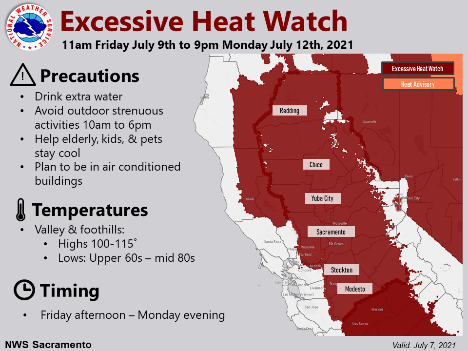
Arnold, CA….The latest, updated excessive heat watch from the National Weather Service in Sacramento. “Dangerously hot conditions may impact the Central Valley and surrounding foothills and mountains. Triple digit heat along with warm overnight lows are possible late this week and into early next week. The combination of the very hot afternoons and warm nights will result in a period of high to very high heat risk. Consequently, an Excessive Heat Watch is in effect Friday through Monday evening.
Excessive Heat Watch
URGENT – WEATHER MESSAGE
National Weather Service Sacramento CA
230 AM PDT Wed Jul 7 2021
…Dangerously hot conditions may impact the Central Valley and
surrounding foothills and mountains…
.Triple digit heat along with warm overnight lows are possible
late this week and into early next week. The combination of the
very hot afternoons and warm nights will result in a period of
high to very high heat risk. Consequently, an Excessive Heat
Watch is in effect Friday through Monday evening.
CAZ013>019-063-066>069-072300-
/O.CON.KSTO.EH.A.0004.210709T1800Z-210713T0400Z/
Shasta Lake Area / Northern Shasta County-
Burney Basin / Eastern Shasta County-Northern Sacramento Valley-
Central Sacramento Valley-Southern Sacramento Valley-
Carquinez Strait and Delta-Northern San Joaquin Valley-
Mountains Southwestern Shasta County to Western Colusa County-
Northeast Foothills/Sacramento Valley-Motherlode-
Western Plumas County/Lassen Park-
West Slope Northern Sierra Nevada-
Including the cities of Shasta Dam, Burney, Redding, Red Bluff,
Chico, Oroville, Marysville/Yuba City, Sacramento,
Fairfield/Suisun, Stockton, Modesto, Alder Springs, Paradise,
Grass Valley, Jackson, Chester, Quincy, and Blue Canyon
230 AM PDT Wed Jul 7 2021
…EXCESSIVE HEAT WATCH REMAINS IN EFFECT FROM FRIDAY MORNING
THROUGH MONDAY EVENING…
* WHAT…Dangerously hot conditions with afternoon highs 100 to
115 degrees. Overnight lows mainly in the upper 60s to mid 80s.
* WHERE…Much of interior northern California.
* WHEN…From Friday morning through Monday evening.
* IMPACTS…High to very high heat risk. Extreme heat will
significantly increase the potential for heat-related illnesses.
PRECAUTIONARY/PREPAREDNESS ACTIONS…
Monitor the latest forecasts and warnings for updates on this
situation. Be prepared to drink plenty of fluids, stay in an air-
conditioned room, stay out of the sun, and check up on relatives
and neighbors.
Young children and pets should never be left unattended in
vehicles under any circumstances. This is especially true during
warm or hot weather when car interiors can reach lethal
temperatures in a matter of minutes.
&&
NWS Issues Excessive Heat Watch for Friday Through Monday! added by admin on
View all posts by admin →