

Bear Valley, CA…Another visit by winter for the western slope of the Northern Sierra Nevada Today Rain at lower elevations…and rain and snow at higher elevations. Breezy. Highs 30 to 45 higher elevations…42 to 52 lower elevations. No snow accumulation lower elevations…3 to 6 inches higher elevations. Snow level 7000 feet decreasing to 5500 feet in the afternoon. Prevailing south winds 5 to 15 mph increasing to 15 to 25 mph in the afternoon. Gusts up to 45 mph. Over ridges…prevailing southwest winds 20 to 40 mph.
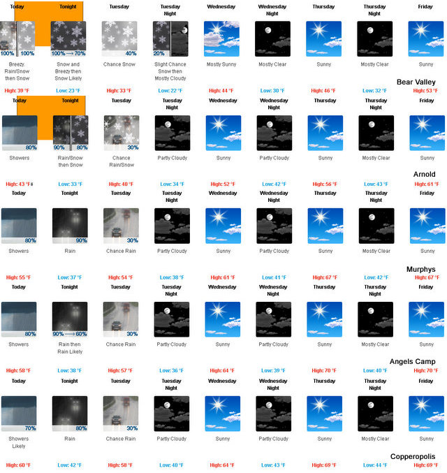
Tonight At lower elevations…rain in the evening…then rain and snow likely after midnight. At higher elevations…rain and snow in the evening…then snow likely after midnight. Colder. Lows 19 to 34 higher elevations…33 to 39 lower elevations. Snow accumulation up to 1 inch lower elevations…except 2 to 8 inches higher elevations. Snow level 5500 feet decreasing to 4500 feet after midnight. Prevailing south winds up to 15 mph with gusts to around 40 mph. Over ridges…prevailing southwest winds 25 to 35 mph decreasing to 15 to 25 mph after midnight. Gusts up to 50 mph over ridges.
Tuesday Mostly cloudy with a chance of rain and snow. Highs 26 to 41 higher elevations…41 to 49 lower elevations. Snow level 3500 feet increasing to 5000 feet in the afternoon. Prevailing southwest winds up to 10 mph.
Tuesday Night Mostly cloudy with a slight chance of rain and snow in the evening…then partly cloudy after midnight. Lows 19 to 34 higher elevations…33 to 39 lower elevations. Snow level 5000 feet. Prevailing west winds up to 10 mph shifting to the east after midnight.
Wednesday Mostly sunny. Not as cool. Highs 36 to 51 higher elevations…51 to 59 lower elevations. Prevailing northeast winds up to 15 mph.
Wednesday Night Mostly clear. Lows 29 to 44.
Thursday Mostly sunny. Not as cool. Highs 43 to 58.
Thursday Night Through Saturday NightMostly clear. Lows 30 to 45. Highs 47 to 62.
Sunday Partly cloudy with a slight chance of rain showers. Highs 50 to 65.
Spring To Make A Return On Wednesday added by admin on
View all posts by admin →