


San Andreas, CA…CAL-FIRE’s mapping tools are pretty incredible now. Click the image below to not only seen the mapping but you can track the air assets assigned to the fire in real time by their location, altitude, etc.
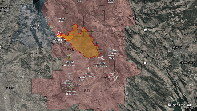

Gann Fire Now 3,759.9 Acres & Growing According to Latest Mapping added by admin on
View all posts by admin →