

Markleeville, CA…Firefighters are still working towards control and containment of the #Washington Fire near Markleeville California. Below is the official update as of the time of this posting. Included is a Google Earth Pro Map of the Fire Perimeter from the official public accessible USGS web site.
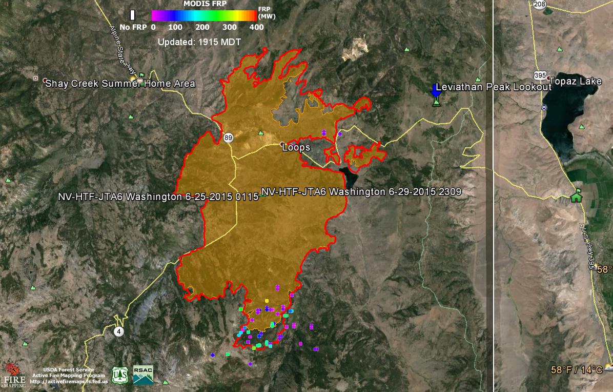
The Red outer perimeter is the latest perimeter file publicly available. The colored dots are heat gradient points or centroids as viewed from the satellites that monitor these fires. Red being the hottest and Purple the coolest. *Disclaimer* Heat points or centroids can be 2 kilometers off due to the curvature of the Earth and Atmospheric conditions.
| Perimeter Contained | 66% |
|---|---|
| Estimated Containment Date | Friday July 31st, 2015 approx. 12:00 AM |
| Fuels Involved | Timber (Litter and Understory) 2 foot tall brush (sage) |
| Significant Events | The fire continues to smolder, creeping in some areas and with single-tree torching |
Outlook
| Planned Actions | Work will continue to secure, mop-up and rehabilitate fire lines. The IMT will continue to support area cooperators for initial attack. Phase demobilization will continue. |
|---|---|
| Projected Incident Activity | Minimal |
| Remarks | Transfer of command from Great Basin IMT-4 to a Type-3 organization is tentatively scheduled for 7/5/15 @ 0600. Isolated sections of perimeter on the east and south flanks will be monitored until they are naturally extinguished due to difficult terrain and low growth potential. |
Current Weather
| Weather Concerns | Scattered thunderstorms formed near the fire Tuesday. Cloudy skies tonight will clear by Wednesday morning. |
|---|
Washington Fire Update Markleevile California added by Charles Dudley Jr. on
View all posts by Charles Dudley Jr. →