


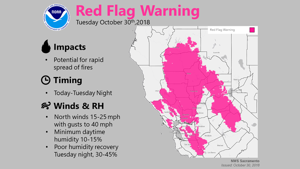
Arnold, CA…Red Flag Warning URGENT – FIRE WEATHER MESSAGE. National Weather Service Sacramento…Critical Fire Weather Conditions Today through Wednesday Morning for Portions of Interior Northern California. High pressure building inland will bring gusty north to east wind over portions of Interior Northern California today through Wednesday morning. These winds will significantly lower humidity and fuel moistures leading to critical fire weather conditions.
CAZ221-266>269-302300-
/O.CON.KSTO.FW.W.0011.181031T0600Z-181031T1800Z/
Stanislaus NF West of the Sierra Crest-
Northern Sierra Foothills from 1000 to 3000 Ft. Includes portions
of Shasta-Trinity and Butte Units-
Northern Motherlode From 1000 to 3000 Ft. Includes portions of
Nevada-Yuba-Placer-Amador and ElDorado Units-
Northern Sierra Including Lassen NP and Plumas and Lassen NF/S
West of the Sierra Crest (West of Evans Peak-Grizzly Peak-
Beckworth Peak)-
Northern Sierra Including the Tahoe and ElDorado NF/S West of the
Sierra Crest-
243 AM PDT Tue Oct 30 2018
…RED FLAG WARNING REMAINS IN EFFECT FROM 11 PM THIS EVENING TO
11 AM PDT WEDNESDAY FOR GUSTY WIND AND LOW HUMIDITY FOR FIRE
WEATHER ZONES 221, 266, 267, 268, AND 269…
* AFFECTED AREA…Fire weather zone 221, 266, 268, and 269. This
includes the eastern foothills, and west slopes of the
Northern Sierra Nevada.
* WIND…Northeast to East wind 10 to 25 mph with local gusts
up to 40 mph. Wind strongest over ridges and through
favorably oriented canyons.
* HUMIDITY…Widespread poor overnight humidity recoveries
overnight Tuesday into Wednesday morning as low as 25 to 35
percent.
* IMPACTS…any fires that develop will likely spread rapidly.
Outdoor burning is not recommended.
Red Flag Warning in Effect from October 30, 11:00 PM until October 31, 11:00 AM added by admin on
View all posts by admin →