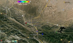
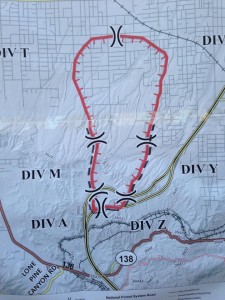
Cajon Junction Ca. The USFS along with CalFire and Regional Fire Fighting Agencies are working a major Vegetation Fire in the Cajon Pass area just North and West of Cajon Junction. The fire was at 3,500 acres and growing from the last report we found. Here is a Google Earth Pro image of the area in question:
Update 7 19 2015 7:30am CalFire #NorthFire Update
Update 7 18 2015 9:24pm InciWeb #NorthFire Update
Image Source InciWeb InciWeb
Update 7 18 2015 8:05 am more updates to follow later in the day.
Update 7 17 2015 8:03 pm 5k acres zero % containment. Rate of spread slowing.
This initial dispatch per the WildCAD Web Site is quite large in size.
07/17/2015 14:33 . 12E4/12K4 12E5 12E6 68R6 AA 12 ANF E338 ANF E37 BC31 BC32 CH1 CREW 1 CREW 5 DIV3 DIV9 Dozer 3 E12 E13 E16 E17 E19 E30 E31 E311 E314 E336 E337 E338 E339 E34 E35 E3637 E3648 E3R E51 E54 H301 H534 H554 PT33 Safety 1 WT12 WT234 WT32 WT56 BDF-9001
NORTH Wildfire NB 15 BETWEEN 138 AND OAKHILLS P5JY2D ENGR 33 Effective 1425 34.318 x 117.510
Here is a very good Fire Agency web site that will help you to keep up on what this massive fire might be doing.
We will try to bring you a Fire Perimeter Map once one becomes available on the Official USGS Web Site that hosts the files.
We here at The Pine Tree want to offer our Prayers for those on the Front Line, in the Air and those working on the Ground to get this massive fire under control in a timely manner. We also want to Pray for those struggling to get out of this fire’s path.


