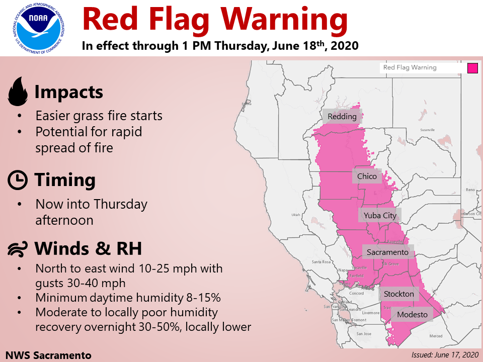
Sacramento, CA…National Weather Service Sacramento has issued a Red Flag Warning for our area through 8pm this evening. Let’s be safe out there…

Red Flag Warning
URGENT – FIRE WEATHER MESSAGE
National Weather Service Sacramento CA
525 AM PDT Wed Jun 17 2020
…Red Flag Warning for Portions of the Central Valley into the
Delta through Early Thursday Afternoon…
.Building high pressure will bring gusty north to easterly winds
through early Thursday afternoon. Daytime humidity will be low
with moderate to locally poor overnight recoveries. The
combination of gusty winds and low humidity will lead to critical
fire weather conditions for the Sacramento Valley, surrounding
foothills, the Delta region, and the northern San Joaquin Valley.
Lighter wind is expected by Thursday afternoon, but daytime
relative humidities will remain low into the weekend.
CAZ220-180000-
/O.EXB.KSTO.FW.W.0002.200617T1500Z-200618T0300Z/
Southern Motherlode From 1000 to 3000 Ft. Includes portions of
Calaveras-Tuolumne Unit-
525 AM PDT Wed Jun 17 2020
…RED FLAG WARNING IN EFFECT UNTIL 8 PM PDT THIS EVENING FOR
GUSTY WIND AND LOW HUMIDITY FOR FIRE WEATHER ZONE 220…
The National Weather Service in Sacramento has issued a Red Flag
Warning, which is in effect until 8 PM PDT this evening.
* AFFECTED AREA…Fire weather zone 220 which includes a portion
of west-central Calaveras County.
* WIND…North to northeast wind 10 to 25 mph with gusts up to
35 mph.
* HUMIDITY…Daytime minimum humidities of 8 to 15 percent
expected with moderate to locally poor overnight recoveries
of 30 to 50 percent.
* IMPACTS…Any grass fires that develop will likely spread
rapidly. Outdoor burning is not recommended.
PRECAUTIONARY/PREPAREDNESS ACTIONS…
A Red Flag Warning means that critical fire weather conditions
are either occurring now, or will shortly. A combination of
strong winds, low relative humidity, and warm temperatures can
contribute to extreme fire behavior.
&&
Interact with us via social media
www.facebook.com/nws.sacramento
www.twitter.com/nwssacramento
$$


