


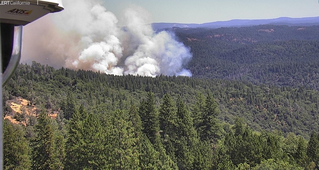
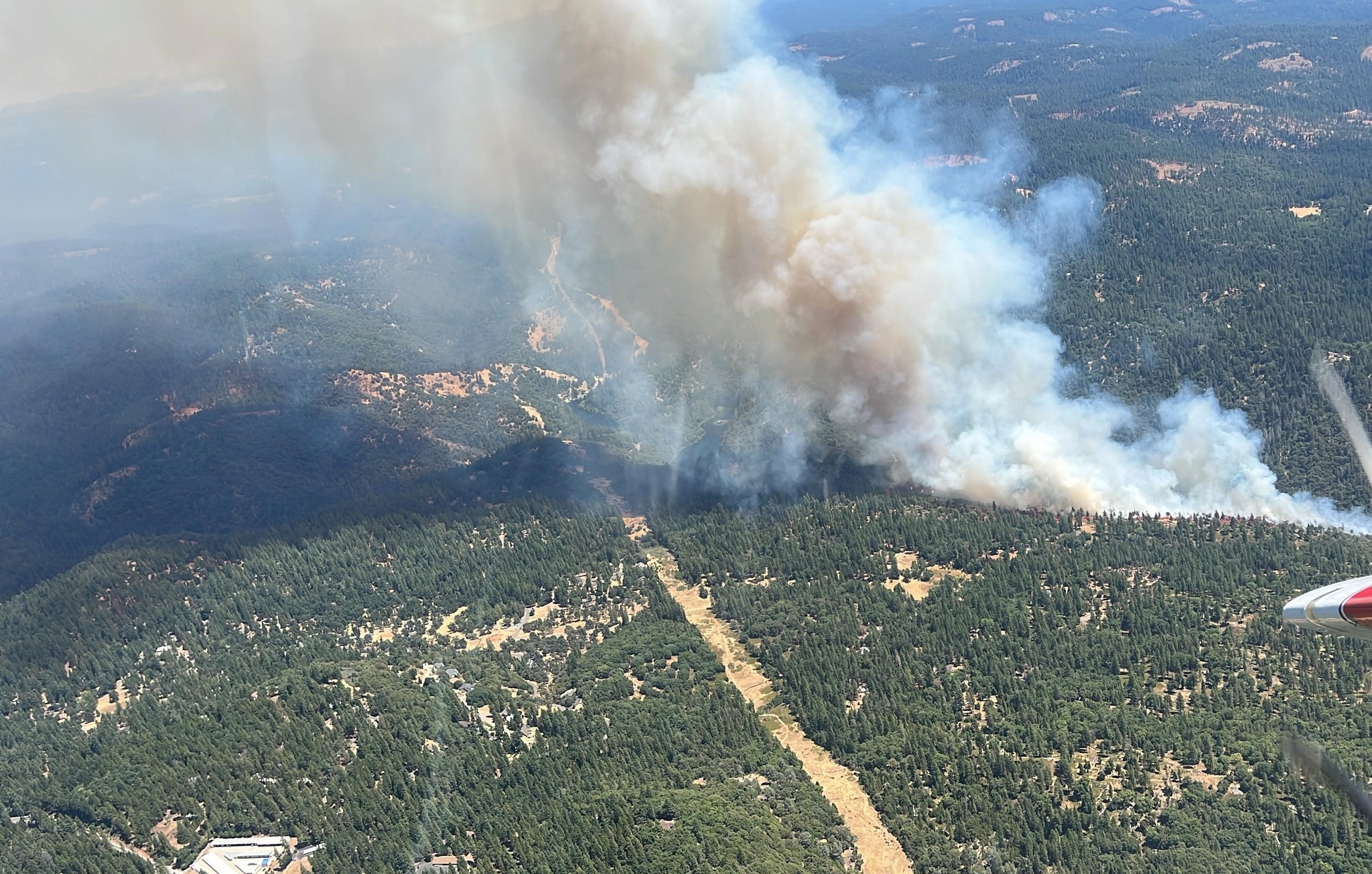
Buckhorn, CA…As we head into the heart of fire season the Tiger Fire has all the ingredients of a potentially bad one. It is burning at an elevation where there is lots of heavy fuel and it is late enough into the season that the fuel moisture load is low. Officially estimated at 34 acres but air attack has it at 60 with spotting ahead of the fire. The latest from CAL FIRE AEU is below…
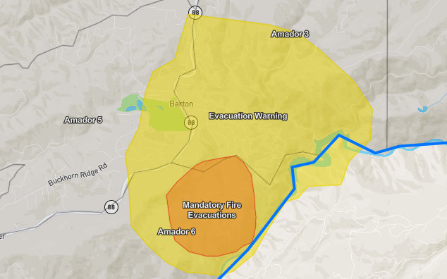
#TigerIncident (update – 1:45 pm): Per the Amador County Sheriff’s Office, evacuation warnings and orders are now in place. The map is at https://perimetermap.com/Amador-CA
#TigerIncident (update – 1:35 pm): Per the Amador County Sheriff’s Office, an evacuation order has been issued. To see the incident map, visit https://perimetermap.com/Amador-CA
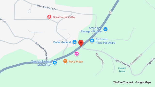
#TigerIncident (New): Ground and air resources are on scene of a vegetation fire in the 28000 block of Tiger Creek Road in Pio…
See more
Traffic & Fire Update….Tiger Fire Now 60 Acres, Localized Evacuations & Fuel to Burn. added by admin on
View all posts by admin →
Why are you showing a map of Pine Grove when the fire is in Pioneer?
Try Buckhorn.
That is where CHP first pinned the fire
When did CHP become Cal Fire?
Should of raked the forest floor!
^^I think you must be a former “doer” of this Adam guy. What, you couldn’t get it up? He didn’t ask you back? You were too small, junkwise? What was it??
Its pretty obvious you got it bad for this Adam dude. So sorry.