

Arnold, CA…Well fall was nice while it lasted! Now a return to summer temps and the corresponding fire risks that they bring. The moisture levels in the potential fuels will remain at the kindling level until the first drenching rains. A sad reminder of this is the deadly Camp Fire in the Paradise Area. It started on November 8th and drenching rains help firefighters get is under control just a few days later.
ThePineTree.net Weather Coverage Sponsored By Fox Security

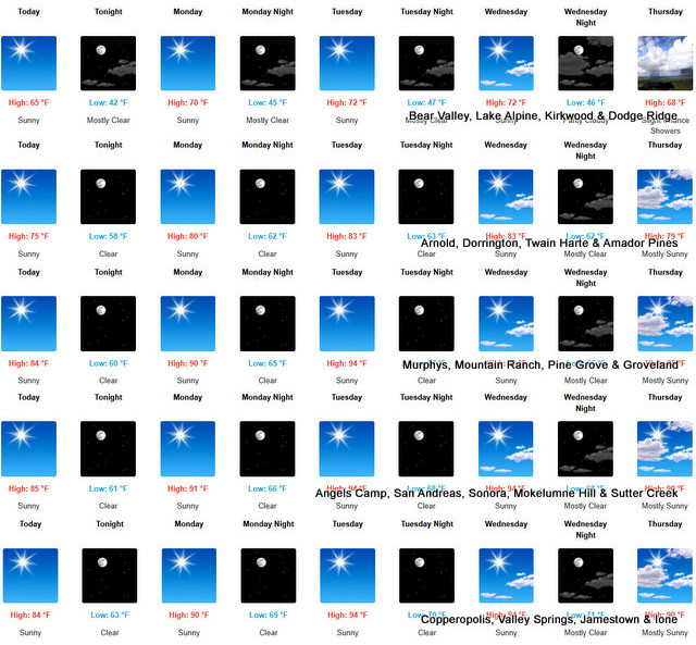
Detailed forecast for
West Slope Northern Sierra Nevada
Today
Sunny. Highs 61 to 76 higher elevations…73 to 85 lower elevations. Prevailing southeast winds up to 10 mph shifting to the southwest in the afternoon.
Tonight
Clear. Lows 41 to 56 higher elevations…51 to 65 lower elevations. Light winds becoming east up to 10 mph after midnight.
Monday
Sunny, warmer. Highs 66 to 81 higher elevations…79 to 89 lower elevations. Prevailing east winds up to 10 mph shifting to the southwest in the afternoon.
Monday Night
Clear. Lows 45 to 60 higher elevations…55 to 70 lower elevations. Light winds becoming east up to 10 mph after midnight.
Tuesday
Sunny, warmer. Highs 69 to 84 higher elevations… 82 to 92 lower elevations. Prevailing east winds up to 10 mph shifting to the southwest in the afternoon.
Tuesday Night
Clear. Lows 50 to 65.
Wednesday
Sunny. Highs 73 to 88.
Wednesday Night And Thursday
Mostly clear. Lows 49 to 64. Highs 71 to 86.
Thursday Night
Mostly cloudy with a slight chance of rain showers. Lows 47 to 62.
Friday
Mostly cloudy with a chance of rain showers. Highs 64 to 79.
Friday Night
Partly cloudy with a slight chance of rain showers. Lows 45 to 60.
Saturday
Partly cloudy with a chance of rain showers. Highs 62 to 77.
Detailed forecast for
Mother Lode
Today
Sunny. Highs 77 to 87. Light winds becoming west up to 10 mph in the afternoon.
Tonight
Clear. Lows 57 to 65. Light winds.
Monday
Sunny, warmer. Highs 83 to 93. Prevailing east winds up to 10 mph in the morning becoming light.
Monday Night
Clear. Lows 60 to 70. Light winds becoming northeast up to 10 mph after midnight.
Tuesday
Sunny. Highs 87 to 97. Prevailing east winds up to 10 mph in the morning becoming light.
Tuesday Night
Clear. Lows 61 to 71.
Wednesday
Sunny. Highs 87 to 97.
Wednesday Night And Thursday
Mostly clear. Lows 61 to 71. Highs 83 to 97.
Thursday Night And Friday
Partly cloudy with a slight chance of rain showers. Lows 61 to 69. Highs 78 to 93.
Friday Night
Partly cloudy with a slight chance of rain showers. Lows 57 to 65.
Saturday
Partly cloudy with a slight chance of rain showers. Highs 75 to 85.
Summer Temps & Elevated Fire Risks Return for West Slope & Mother Lode ~ Coverage Sponsored By Fox Security added by admin on
View all posts by admin →