

Bear Valley, CA…12/22/2025, Hey Good People! The rain is still falling as we wait for the temp to drop, then, GAME ON! 1.32″ of rain fell over the last 24hrs, far less than what was expected but we also saw that the model runs were showing some in and out rain for yesterday and that stayed true to the forecast as the bigger rain totals decided to stay North of Hwy 50.
Alpine Meadows saw rain all day yesterday for comparison.
The high today will again rise up into the upper 30’s with 38F being the target. Winds will be out of the SSE in the teens with gusting into the 20’s. Mixed rain with some possible snow will fall over the next 24hrs then we will start to see some accumulation of snow late Tuesday afternoon with 2-4″ possible before turning to all snow early Wednesday morning. This is when the magic will begin! 10-14″ Wednesday, 10-16″ Wednesday night, 9-13″ for Thursday day, 10-16″ Thursday night, 11-17″ on Friday then tapering off with 2-4″ Friday night before the system exits East.
OK, now for some personal experience thrown in here……………
The days originally suggested for this system to drop snow have compressed a bit, meaning the system is now showing a slightly shorter duration. In my experience this usually gives way to less snowfall than some forecasts may push out despite the totals for a 6 day event versus them compressing into a 4 day event. It’s not an absolute but I have seem this many times before. Does this mean not that much snow? No, what it does mean is I think we will be very fortunate to receive the possible totals on the upper end of the forecast but my gut is telling me we likely will be in the 3-4′ range and a super bonus if we end up getting more. Again that is solely based on 30+ years of paying attention to weather for the resort and avalanche control work.
Certainly the POWDER skier in me wants the upper end numbers of 5-6’+ but like the last few days, we can only wait and see how it plays out. I would definitely prepare ones mindset for the upper end totals for preparedness and navigation of the storm while traveling or while here in BV.
All Nordic Center and Mountain operations as well as Garrett with the County and Tim Schimke with his snow removal crew in town will certainly have our hands full digging out and getting operations up and running smoothly.
It certainly feels a little like a Christmas miracle for snowfall production as this is what we all wait all summer and fall for.
Happy Holidays to everyone and get yer shovels and snow blowers ready!!!
Peace Out,
Mattly Trent
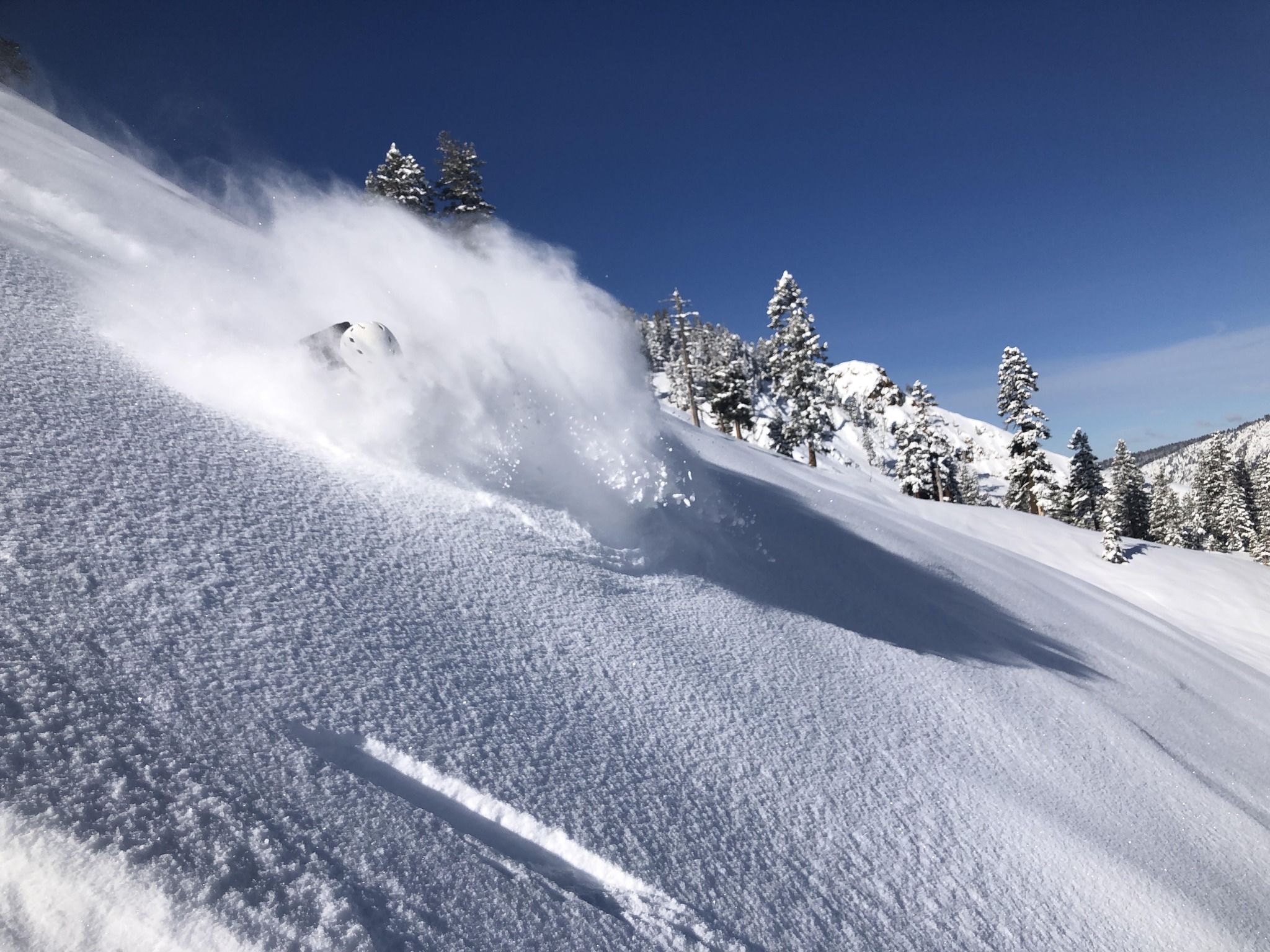
pic: Johan Henkins getting deep on Vortex a few seasons ago during avalanche control (he is 6’4″)
Mattly’s Weather for December 22nd! Hey Good People!! Mattly Trent Weather Reports are Back!! added by admin on
View all posts by admin →
oh no…………not again.