


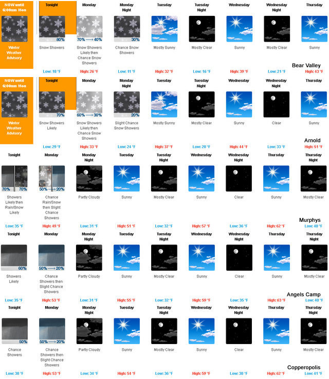
Arnold, CA…A bit of weather returns just to show us that winter isn’t done with us yet. Along the West Slope Northern Sierra Nevada…Tonight Showers likely. Lows 15 to 30 higher elevations… 29 to 35 lower elevations. Snow accumulation of 2 to 5 inches. Snow level 3000 feet. Prevailing southwest winds 5 to 15 mph with gusts to around 35 mph…except southwest 20 to 30 mph over ridges. Monday Mostly cloudy. Snow showers likely in the morning, then a chance of snow showers in the afternoon. Highs 20 to 35 higher elevations…35 to 43 lower elevations. Snow accumulation of 1 to 2 inches. Prevailing southwest winds up to 10 mph with gusts to around 25 mph. Over ridges, prevailing southwest winds 15 to 25 mph decreasing to 5 to 15 mph in the afternoon.
The Latest Weather & Road Conditions Are Always On Our Weather Page
Monday Night Mostly cloudy in the evening then becoming partly cloudy. A slight chance of snow showers. Colder. Lows 9 to 24 higher elevations…24 to 32 lower elevations. Prevailing southwest winds up to 10 mph shifting to the southeast after midnight.
Tuesday Partly cloudy. A slight chance of snow showers in the morning, then a slight chance of flurries in the afternoon. Not as cold. Highs 25 to 39 higher elevations…38 to 46 lower elevations. Prevailing east winds up to 10 mph in the morning becoming light.
Tuesday Night Mostly clear. Lows 14 to 29 higher elevations… 28 to 34 lower elevations. Light winds becoming east up to 10 mph after midnight.
Wednesday Sunny. Not as cool. Highs 36 to 51.
Wednesday Night Clear. Lows 21 to 36.
Thursday Through Friday Night Mostly clear. Highs 41 to 56. Lows 24 to 39.
Saturday Partly cloudy. Highs 40 to 55.
Saturday Night And Sunday Partly cloudy with a slight chance of rain and snow showers. Lows 29 to 44. Highs 38 to 53.
One product issued by NWS for: 11 Miles WSW Ebbets Pass CA Share|
Winter Weather Advisory
URGENT – WINTER WEATHER MESSAGE
National Weather Service Sacramento CA
1155 AM PST Sun Feb 26 2017
CAZ069-271200-
/O.EXT.KSTO.WW.Y.0011.170227T0100Z-170227T1400Z/
West Slope Northern Sierra Nevada-
Including the city of Blue Canyon
1155 AM PST Sun Feb 26 2017
…WINTER WEATHER ADVISORY NOW IN EFFECT FROM 5 PM THIS AFTERNOON
TO 6 AM PST MONDAY…
* TIMING…Snow will begin late this afternoon, be heaviest this
evening, and will taper off to light snow Monday morning.
* MAIN IMPACT…Weekend travelers could experience travel
delays, chain controls, and slick roadways.
* SNOW AMOUNTS…Between 3 and 7 inches of snow expected for
mountain passes, including Interstate 80 and Highway 50. Lighter
amounts of snow up to 1 inch can be expected down to 2000 feet.
PRECAUTIONARY/PREPAREDNESS ACTIONS…
A Winter Weather Advisory for snow means that periods of snow
will cause primarily travel difficulties. Be prepared for snow
covered roads and limited visibilities, and use caution while
driving.
&&
Moisture Falling From The Sky Yet Again…Not Too Much This Time Though added by admin on
View all posts by admin →