

Groveland, CA…The image below is not to be used to decide whether to evacuate or not. If you get a door knock, go. It is just to indicate in a non-real time basis an approximate look at the hot spots of this fire. The satellites can pick up elevated heat as well and not just fires actually on the ground. Ok, with those disclaimers, the latest image from the Northern California Geographic Area Coordination Center is below…you can see fire is well established on both sides of Hwy 49 with the obvious concerns that it could climb the hills into the Big Oak Flat and Groveland areas. At the time of this post Hwy 120 on New Priest Grade is open for evacuations according to the latest from CHP. Hwy 120 & Hwy 49 are closed to normal traffic in the fire areas…
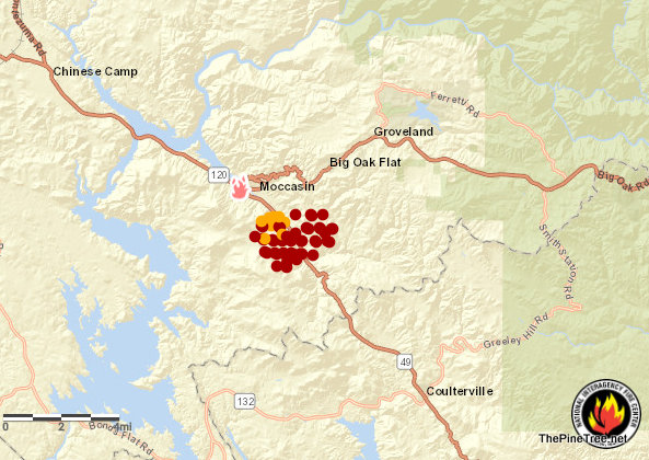
MocFire Satellite, Non-Real Time Heat Signature Map added by admin on
View all posts by admin →