

San Andreas, CA…Zonehaven works by breaking the entire county into “Zones”. Each zone has a corresponding number on the map. A resident need only to know their Zone identification number to know if they need to evacuate and when it is safe to repopulate. During an emergency, the Zone number will be provided along with clear evacuation instructions. Zonehaven will provide traffic in real-time, identify possible evacuation center locations and use the latest event information provided by the Incident Commander as the event unfolds.
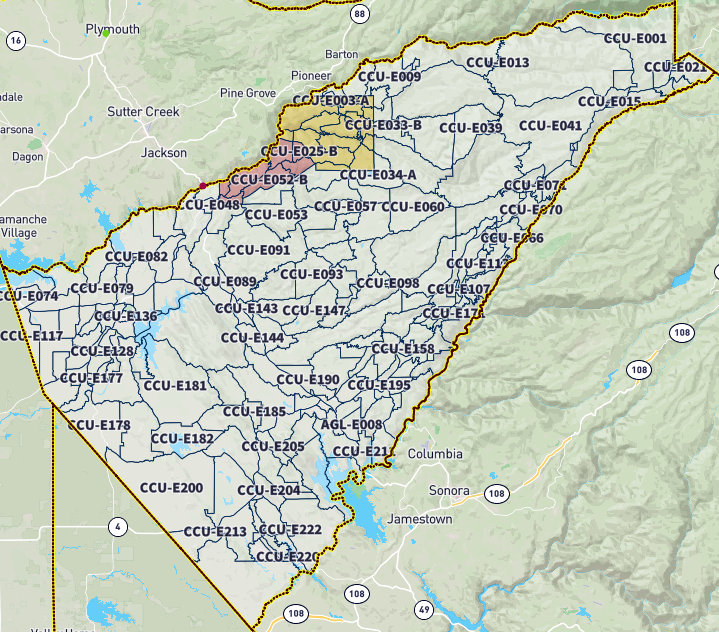
“Know our Zone.” Be prepared by knowing your Zone. It is easy to locate your Zone by visiting Zonehaven’s web page at https://community.zonehaven.com/. Residents are able to find their zone by entering their address into the interactive search bar. This will open a pop-up window which will include your zone name, information about the zone, and its emergency services. Residents are encouraged to look up and record the names of all the zones they frequent–such as home, work, school, or homes of loved ones–and keep them in an easily visible place. The map is updated in real-time, so you should check it regularly for new information. If you are still having trouble locating your Zone, please reach out to Calaveras County OES via email at ccoes@co.calaveras.ca.us or 211.
The County will continue outreach efforts to raise awareness of this important new evacuation management tool.
Link to Zonehaven search box to look up your zone from your address: Zonehaven AWARE | Find your Evacuation Zone now
All evacuation orders, evacuation warnings, and road closures in Calaveras County remain unchanged.
###
Calaveras County Announces Implementation of New Evacuation Management Plan “Zonehaven” added by admin on
View all posts by admin →