

Angels Camp, CA…Some years the fall colors creep up mixing ruffling green leaves with a dusting of yellow as early as late August. Other times, fall colors explode on the scene in unison, as if by plan. With Calaveras’ moderate fall temperatures and clear skies, fall is always a sight to behold and the perfect time to do some hiking, mountain biking, or leisurely driving.

Whether you live nearby or traveling between Yosemite and Lake Tahoe, visit Calaveras this fall for the colorful and pristine autumn show. Just a short drive from the San Francisco Bay Area or Sacramento, a drive to Calaveras should definitely be on your list of places to visit.
Ebbetts Pass Scenic Byway
Scenic Drive: Highway 4 from Copperopolis to Bear Valley: Drive Highway 4 up to Bear Valley and enjoy beautiful fall colors all the way up. Weather permitting, drive to Dorrington (just past Arnold), turn right at Boards Crossing and drive about 5 miles to Sourgrass Day Use.
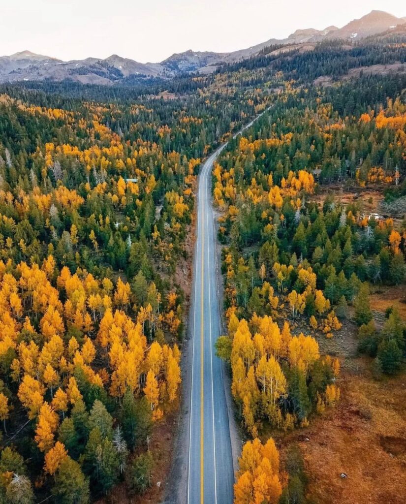
Situated along Highway 4, running east through the High Sierra, the Ebbetts Pass corridor’s fall colors typically begin showing before moving towards the historic Gold Country towns. If road conditions and weather allow, take a drive along the upper scenic Ebbetts Pass National Scenic Byway, one of just seven nationally designated byways in California. This 61-mile stretch of Highways 4 and 89 winds through glacially carved valleys and deep river canyons, stands of Giant Sequoia, granite outcroppings and even hot mineral pools. It’s some of the most awe-inspiring and breathtaking scenery in the Sierra Nevada mountain range unlike anything you’ll find in the big cities. The Scenic4.org website states “At both ends of the byway (between Arnold and Lake Alpine to the west and between Markleeville and Silver Creek to the east), the road is a modern, full-width, two-lane State Highway that is maintained for year-round travel, with a double yellow center line, shoulders and passing lanes. Visitors travel through seemingly endless miles of pristine scenery, interjected only occasionally by welcoming communities. However, in the middle portion between Lake Alpine and Silver Creek, the road and the travel experience changes dramatically, becoming a narrow two-lane road with no center line and no shoulders as it slowly winds its way up and over the Sierra crest.” Watch this video produced by www.scenic4.org (around the four-minute mark) for a sample of what this incredible fall drive is like.
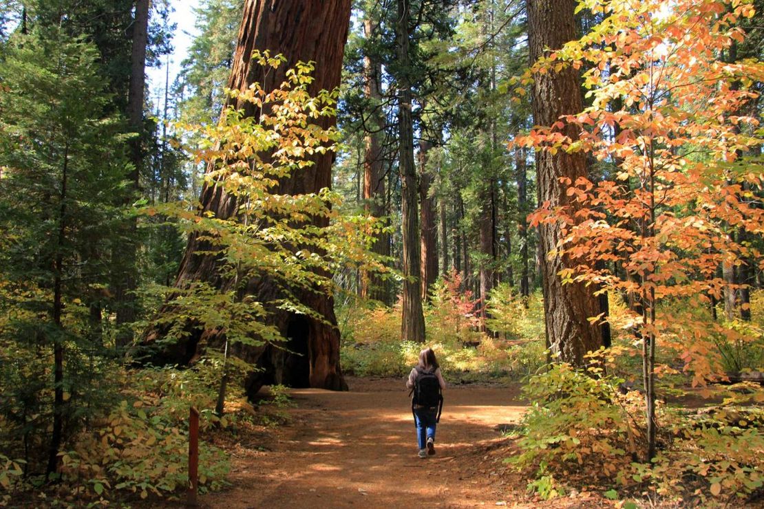
Looking for dogwoods? The gorgeous dogwoods start showing their fall colors going from yellow to orange, to red, and then to a near translucent pink just before the leaves fall, and can be found anywhere from Avery to Calaveras Big Trees State Park. The best trails to find dogwoods are at Big Trees State Park, on the Arnold Rim Trail and at White Pines Lake. Choose the 1.5 or 3.5 mile North Grove loop trails at Calaveras Big Trees, perfect short trails for winter exercise. Bring your hiking boots, mountain bikes, or your horses to the Arnold Rim Trail which has trails for hiking, biking, and horseback riding! White Pines Lake has a playground, serene fishing, disc golf, and bbq areas making it the perfect fall family outing.

Mokelumne River
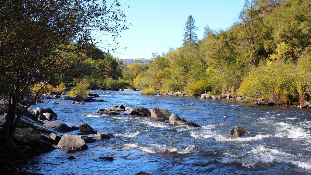
Scenic Drive: Highway 49 from Angels Camp to Mokelumne Hill: Drive down the Golden Chain Highway (Highway 49) and you will see three of Calaveras’ four historic towns – Angels Camp, San Andreas, and Mokelumne Hill. Drive a little past Mokelumne Hill to the Middle Bar Bridge area and access the Mokelumne River. A nice place to get out, walk around a bit, and maybe have a picnic among the golden-hued trees.
Scenic Drive: Highway 49/26: Head to Mokelumne Hill and drive east Highway 26. Continue past the mountain town of West Point and eventually will come to Highway 88 in Amador County. Take 88 back down through Jackson back to Highway 49 to loop back to Mokelumne Hill and into Calaveras County.
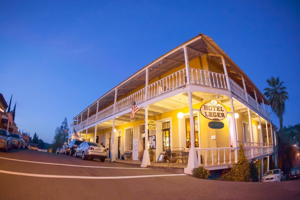
From Highway 49, make sure to turn in to see historic downtown Mokelumne Hill. Sometimes, it’s easy to miss, so remember it’s just a little past (or before) the 4-way stop.Usually open Thursday – Sunday, this is a great place to stop to have a great meal at the Hotel Leger or Renegade Winery, a picnic in Shutter Tree park under colorful foliage, and shop in unique gift shops and art galleries. Posterity Ciderworks, a family-owned-and-operated hard cider crafter, is well worth the visit and tasting if you are a hard-cider connoisseur. Featured in two Michelin-star restaurants in Sacramento, don’t miss this gem tucked in our hills.
Head southwest about 3 miles to the Mokelumne River. Turn right on Big Bar Road, then left on Big Bar Launch. You can walk out on Electra Road for about three miles to take in the gorgeous orange, yellow, and red leaves and the temperatures are still pretty mild this times of year.
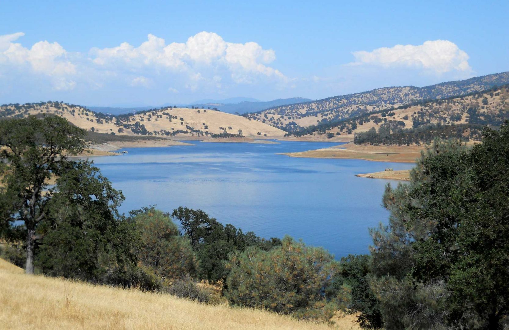
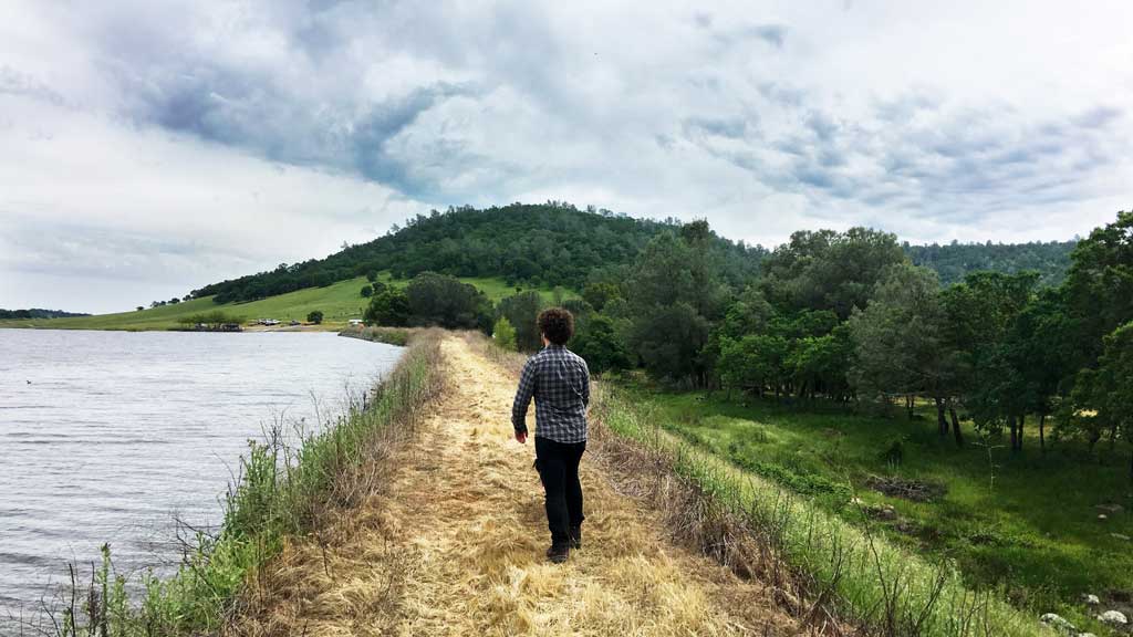
New Hogan Reservoir
Scenice Drive: Highway 12/26: Whether you’re coming from the SF Bay Area, Sacramento, or the San Joaquin Valley area, this gently winding drive to New Hogan Reservoir will be filled with autumn colors, beautiful farmlands, and maybe a pumpkin patch along the way!
New Hogan Reservoir hikes are great if you are looking for fall colors, but a little bit warmer temperatures. Below the dam at the Monte Vista Recreation area, you will find the River of Skulls trail, an easy, .9 mile loop hiking trail. There is also a staging area for an eight mile equestrian trail to enjoy a scenic loop that winds along the foothills and lake. The west side of the lake includes bicycle trails that can be enjoyed by beginners and advanced riders. Easy to moderate loop trails ranging 5 to 10 miles include Cameron, Coyote, and Hogan and are dog-friendly (just keep them on a leash).
Scenic Drive: Another nice little drive from Valley Springs to Lake Pardee through Campo Seco. From Highway 26, turn on Laurel Street, then right on Daphne. Continue onto Paloma Road, keeping left onto Watertown Road. Turn right on Campo Seco Road, then left on Sandretto Road following it all the way Pardee Dam Road to the vista point. From here, you will get to soak in a view of the blue lake and all of the fall colors.
See historical markers along the way telling the story of communities of indigenous people and gold fortune-seekers all while winding through peaceful country backroads.
Copperopolis & Salt Spring Valley Reservoir
Scenic Drive: From Highway 4 in Copperoplis, turn on Rock Creek Road and drive for about 8 miles through beautiful tree-line farm land.
Turn left at the end of the road to drive around Salt Springs Valley Reservoir. Drive to Milton Road and turn left which will take you back to Highway 4. Turn left here and get back to Copperopolis or turn right and head towards Highway 99/Stockton.
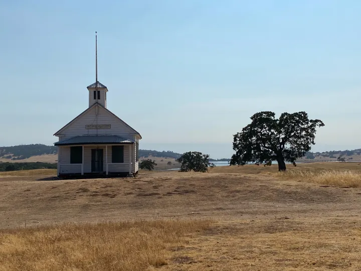
Salt Spring Schoolhouse between Copperopolis and Salt Spring Valley Reservoir
Or, turn right on to Felix Road, then left on Salt Springs Valley Road to drive past the old Salt Springs Schoolhouse. This schoolhouse was the one used in the filming of Little House on the Prairie. From there you have several options – Turn right at Hunt Road which will take you back to Highway 4 where you can turn left to head to Angels Camp or right to head back to Copperopolis. Turn left at Hunt Road and drive all the way to Milton Road and turn left which will also take you back to Highway 4. Turn left here and get back to Copperopolis or turn right and head towards Highway 99/Stockton.
Your third option here is to turn left from Salt Spring Valley Road onto Hunt Road, then turn right onto Hogan Dam Road which will take you all the way back and around the southern tip of New Hogan Lake. Stop in the Monte Vista Day Use and make your way to the River of Skulls trail to see where Spanish explorer Gabriel Moraga found many Native American skulls along the riverbank in 1806 and declared the area “Calaveras”, Spanish for “skull”. From here, turn left on Silver Rapids Road which will take you back out to Highway 26 where you can turn right to get back to Valley Springs or left to head towards Stockton.
Want to stay a few days? We’d love to have you! Click here for where to stay, where to eat, and things to do throughout Calaveras! Or, give us a call at 209-736-0049 at the Calaveras Visitors Bureau for help planning your next visit to Calaveras. We look forward to seeing you!
Happy travels!
Where to Find Fall Colors in Calaveras ~ CVB Feature added by admin on
View all posts by admin →