


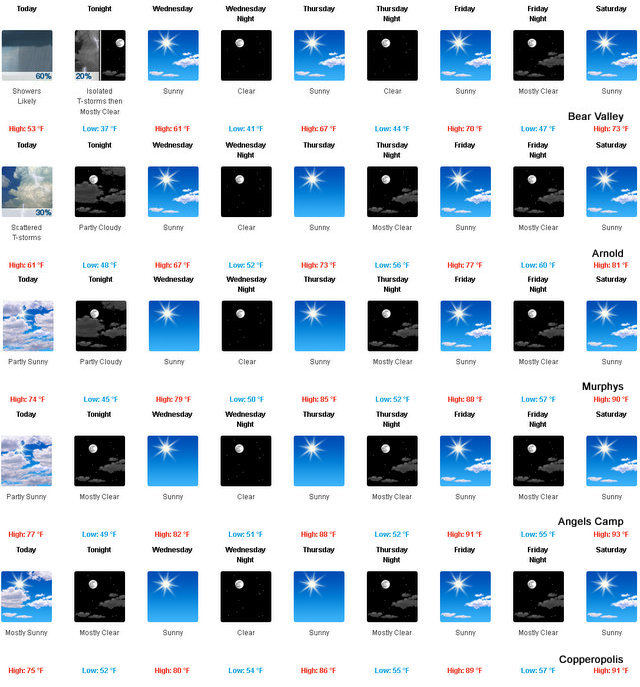
Arnold, CA…The first bit of snow fell overnight in the high country as overnight temps have begun to slip into fall like territories in the West Slope of the Northern Sierra Nevada. Today Mostly cloudy. Scattered rain showers and isolated thunderstorms in the morning…then scattered showers and thunderstorms in the afternoon. Highs 48 to 63 higher elevations…63 to 69 lower elevations. Light winds becoming southwest up to 10 mph in the afternoon. Tonight
Partly cloudy. At higher elevations…isolated showers and thunderstorms in the evening. Colder. Lows 31 to 46 higher elevations…42 to 52 lower elevations. Prevailing southwest winds up to 10 mph shifting to the east after midnight.
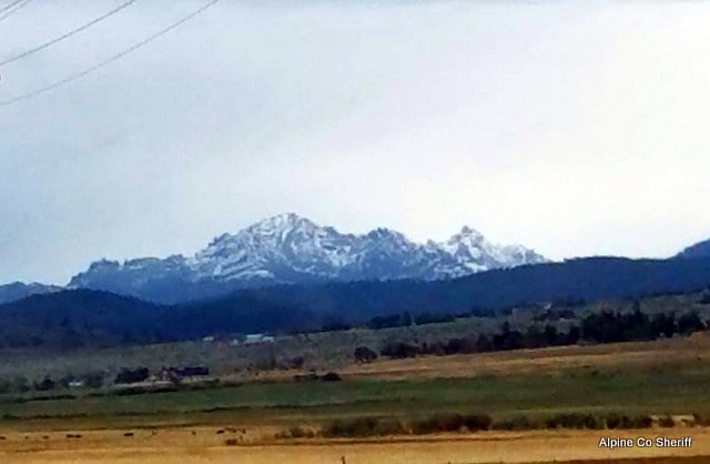
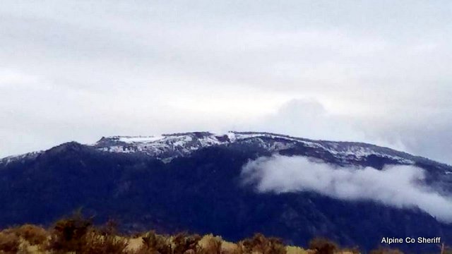
The Alpine County Sheriff’s Department took some pictures of the overnight snow that dusted the mountains. We also always have the latest weather and road conditions on our weather page.
Wednesday
Sunny…warmer. Highs 55 to 70 higher elevations… 68 to 76 lower elevations. Prevailing east winds up to 10 mph shifting to the west in the afternoon.
Wednesday Night
Clear. Lows 36 to 51 higher elevations…48 to 57 lower elevations. Prevailing west winds up to 10 mph shifting to the east after midnight.
Thursday
Sunny…warmer. Highs 61 to 76 higher elevations… 75 to 81 lower elevations. Prevailing east winds up to 10 mph shifting to the west in the afternoon.
Thursday Night
Clear. Lows 42 to 57.
Friday
Mostly sunny. Warmer. Highs 68 to 83.
Friday Night And Saturday
Clear. Lows 46 to 61. Highs 69 to 84.
Saturday Night Through Monday
Mostly clear. Lows 48 to 63. Highs 71 to 86.
A Bit Of Fall Has Crept Into Our Temps added by admin on
View all posts by admin →