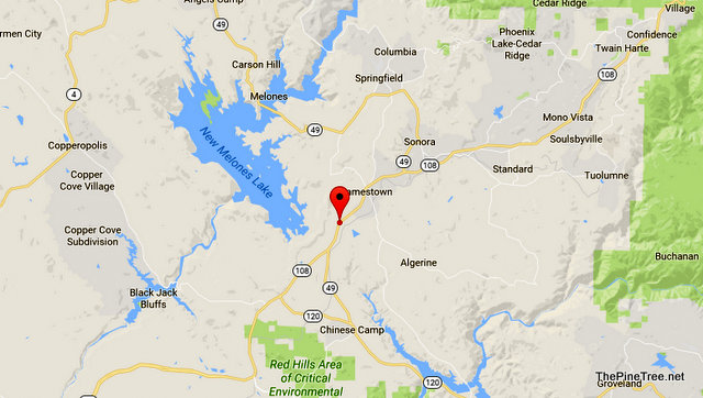
Sonora, CA…The pace of road condition changes has accelerated to where we could do almost non-stop updates. To curb against just a flood (ok bad choice of words) we will be doing hourly updates and bundle them together a bit. At the top of this update is the latest mud, dirt & rocks in the roadway update on Hwy 108 near Chicken Ranch Road. The other updates within the last hour area below…

Incident: 00451 Type: Mud/Dirt/Rock Location: Sr108 / Chicken Ranch Rd Loc Desc: WB Lat/Lon: 37.935047 -120.443128 Close
Detail Information
NO DETAILS
Unit Information
6:08 PM 3 Unit Assigned
6:08 PM 2 Unit Enroute
Incident: 00297 Type: Roadway Flooding Location: Coal Mine Rd / Buena Vista Rd Loc Desc: Lat/Lon: 38.287656 -120.911711 Close
Detail Information
6:07 PM 1 [2] 1039 AMA SO FOR CORDS
Unit Information
6:08 PM 1 Unit Assigned
Incident: 00448 Type: Mud/Dirt/Rock Location: Obyrnes Ferry Rd / Sr108 Loc Desc: NB FRM SR108 Lat/Lon: 37.885417 -120.499140 Close
Detail Information
6:03 PM 2 [4] 1039 CO RDS
6:03 PM 1 [3] 1039 61`-1
Incident: 00442 Type: Roadway Flooding Location: Sr132 / La Grange Rd Loc Desc: BETW ROBERTS FERRY Lat/Lon: 37.663641 -120.462366 Close
Detail Information
5:59 PM 2 [4] 1039 CO RDS
5:57 PM 1 [2] RDWY FLOODED
Unit Information
6:03 PM 2 Unit Assigned
6:03 PM 1 Unit Enroute
Incident: 00443 Type: Mud/Dirt/Rock Location: Phoenix Lake Rd / Old Phoenix Lake Rd Loc Desc: Lat/Lon: 38.004235 -120.308870 Close
Detail Information
6:01 PM 3 [6] 1039 CO RDS, ALREADY BEEN ADVSD
5:59 PM 2 [3] 1039 48-30
5:57 PM 1 [1] 1125 RDWY
Unit Information
6:00 PM 2 Unit Assigned
6:00 PM 1 Unit Enroute
Incident: 00437 Type: Mud/Dirt/Rock Location: Sr49 / Schilling Rd Loc Desc: JNO AND JSO BAGBY BRIDGE Lat/Lon: 37.694764 -120.182822 Close
Detail Information
5:52 PM 1 [3] 1039 61-4
Incident: 00286 Type: Mud/Dirt/Rock Location: Fiddletown Silver Lake Rd / Sr88 Loc Desc: SHAKE RIDGE 1 MILE JWO SR88 Lat/Lon: 38.512843 -120.485114 Close
Detail Information
5:49 PM 1 [3] BLKNG RDWY
Unit Information
5:53 PM 1 Unit Assigned
Incident: 00265 Type: Traffic Hazard Location: Jackson Valley Rd / Sr88 Loc Desc: UPPER JV 2 MILES OFF SR88 Lat/Lon: 38.329966 -120.907078 Close
Incident: 00401 Type: Traffic Hazard Location: Sr108 / Little Sweden Loc Desc: JWO 1 MILE Lat/Lon: 38.084172 -120.157525 Close
Detail Information
5:03 PM 1 [2] PER VICS, GAVE THE INVD PTY A 2 HR ETA
Unit Information
4:44 PM 4 Unit Assigned
4:44 PM 3 Unit Enroute
4:44 PM 2 Unit At Scene
5:11 PM 1 Unit Cleared


