

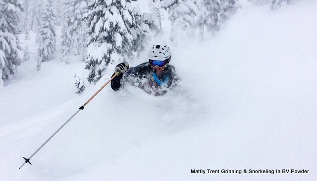
Bear Valley, CA…Hey Good People! Clear skies and crisps morning temps are what’s happening currently here at Bear Valley. The recent storm totals are off the hook with 113″ for the storm total and 144″ for our current base. The Mtn Ops team made incredible headway yesterday and as most of you know we chose to close so we can recover and move mega amounts of snow. Just wait until you see the main bowl area!!! Today we expect the high to come in around 26F with ENE winds from 0-6 mph and a slight chance of snow showers. High pressure will make it’s way into the area by later this afternoon and bring sunshine for the next 4-5 days and some possible breezy conditions come Friday as the pressure gradient tightens up a bit. We’re still assessing the Lwr mtn for Avalanche hazards which remain at 3 Considerable currently but patience is the key here. Ski Patrol was able to start control work on the Lower Mountain Monday off the Gunmount and will be heading down there again today to continue that work. Until then copious amounts of quality riding is to be had on the frontside/backside and village sides of our Mtn. Stay safe, ride with a friend and be aware of deep tree wells as they are abundant inbounds and in the soft boundaries. Come on up and check out our local “Pure Mtn Fun” ethos and stay tuned……….

Tuesday
Isolated snow showers before 10am. Partly sunny, with a high near 26. East northeast wind around 6 mph becoming light and variable in the afternoon. Chance of precipitation is 20%.
Tuesday Night
Partly cloudy, with a low around 13. East northeast wind around 6 mph.
Peace Out
Mattly
Might Be the Best Day of The Season – 113″ Storm Total added by admin on
View all posts by admin →