


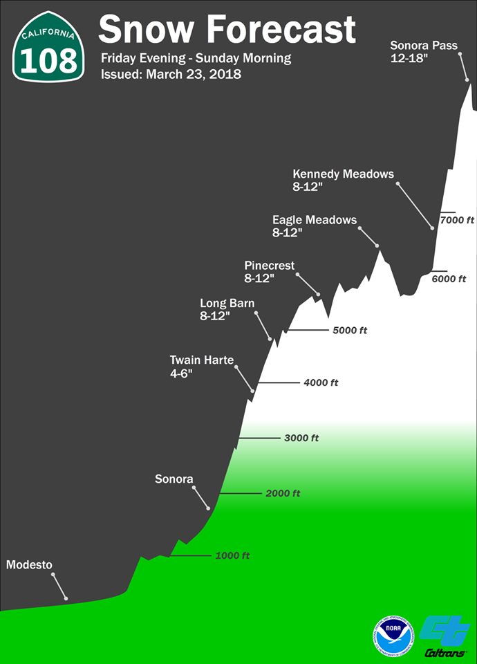
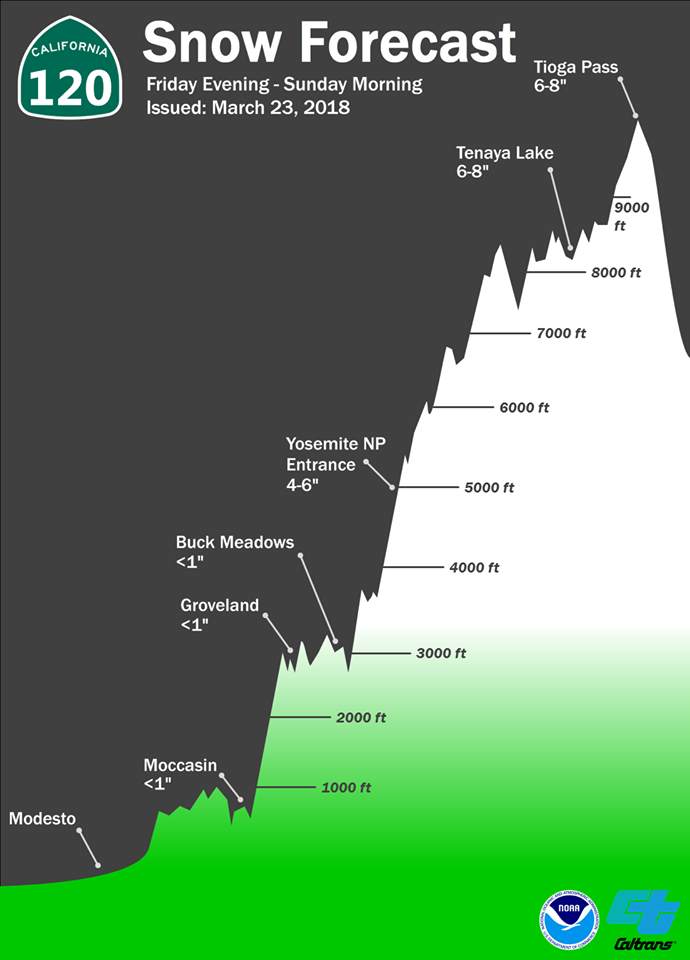
Arnold, CA…From the National Weather Service…Significant low elevation snow into the weekend. A cold system with lower snow levels and heavy snow will drop south over the region into the weekend. The heaviest snow will be tonight with a second round Saturday night. Significant travel delays are expected.
Winter Storm Warning
URGENT – WINTER WEATHER MESSAGE
National Weather Service Sacramento CA
1036 AM PDT Fri Mar 23 2018
…Significant low elevation snow into the weekend…
.A cold system with lower snow levels and heavy snow will drop
south over the region into the weekend. The heaviest snow will be
tonight with a second round Saturday night. Significant travel
delays are expected.
CAZ069-241745-
/O.EXT.KSTO.WS.W.0008.180324T0600Z-180325T1600Z/
West Slope Northern Sierra Nevada-
1036 AM PDT Fri Mar 23 2018
…WINTER STORM WARNING NOW IN EFFECT FROM 11 PM THIS EVENING TO
9 AM PDT SUNDAY…
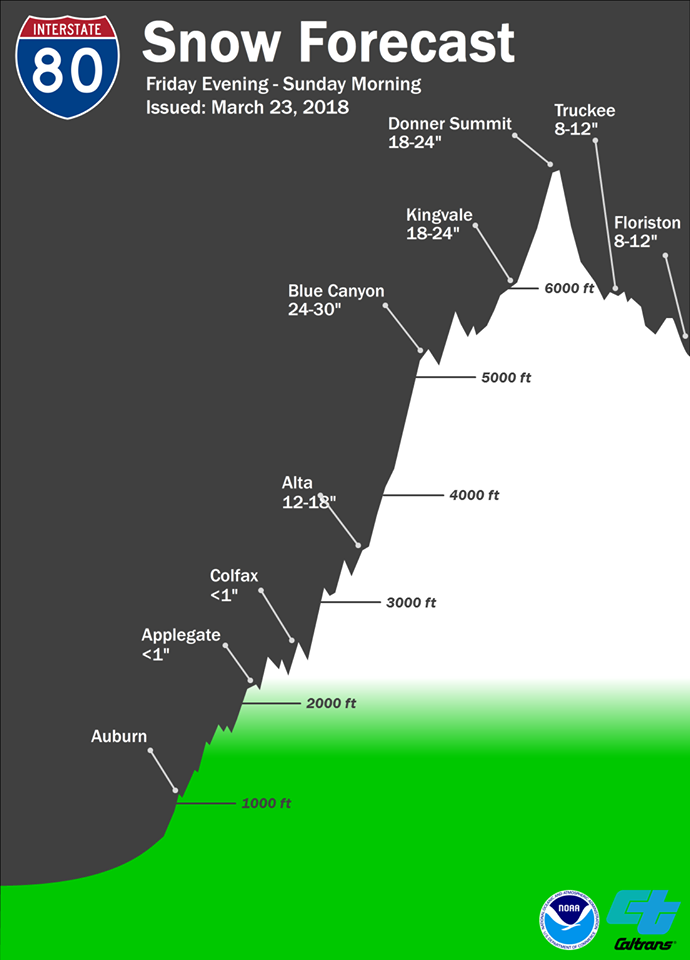
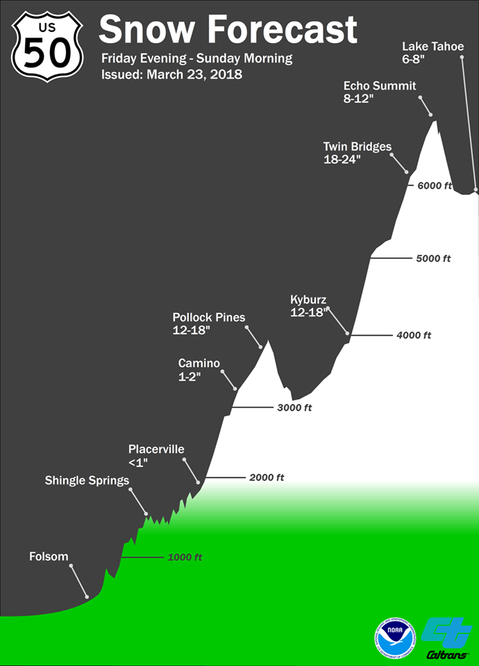
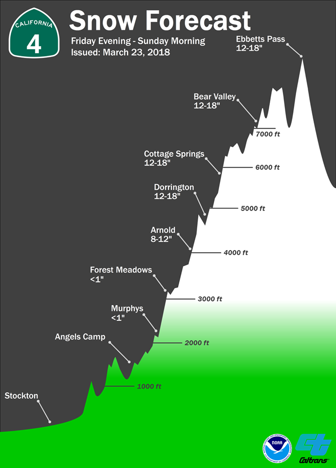
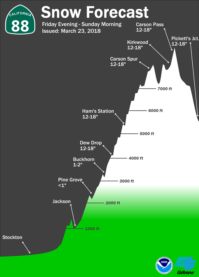
* WHAT…Heavy snow expected. Travel will be very difficult. Total
snow accumulations of 12 to 18 inches, with localized amounts up
to 30 inches, are expected.
* WHERE…West Slope Northern Sierra Nevada including Interstate
80 over Donner Pass, Highway 50 over Echo Summit and Highway 88
over Carson Pass.
* WHEN…Heaviest tonight and again Saturday night.
* ADDITIONAL DETAILS…Be prepared for significant reductions in
visibility at times due to heavy snow and gusty winds.
PRECAUTIONARY/PREPAREDNESS ACTIONS…
A Winter Storm Warning for snow means there will be snow covered
roads and limited visibilities. Travel is not recommended while
the warning is in effect. If you must travel, keep an extra
flashlight, food and water in your vehicle in case of an
emergency.The latest road conditions for the state you are
calling from can be obtained by calling 5 1 1.
$$
Updated Storm Warning With Low Elevation Snow as Temps Turn Colder added by admin on
View all posts by admin →