


Arnold, CA…From the National Weather Service Sacramento, you can expect Moderate to Heavy Rainfall Friday Through Saturday. A strong atmospheric river will bring wet weather Thursday into the weekend. Snow levels will initially be well above pass levels, bringing rain across the area, including the mountains. Some snow melt is possible due to the rainfall and warm temperatures. Stream and creek levels are expected to rise, and could cause local flooding. Ponding on roads is also possible, as well as rock and mud slides.
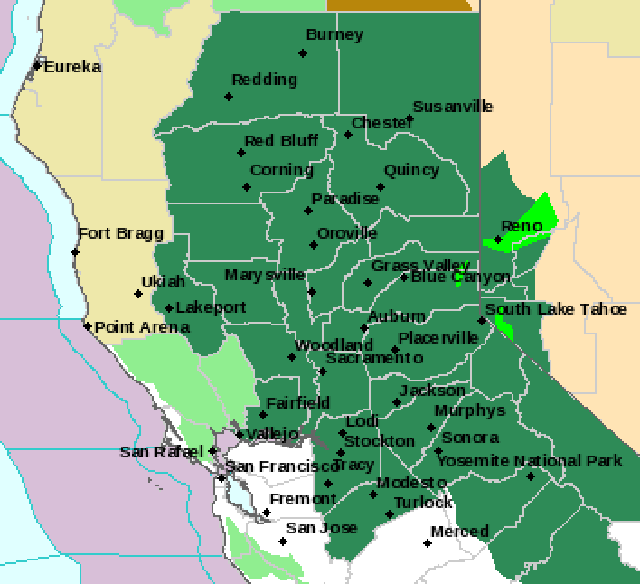
The National Weather Service in Sacramento has issued a * Flood Watch for a portion of northern California…including the following areas…Burney Basin / Eastern Shasta County, Carquinez Strait and Delta…Central Sacramento Valley…Clear Lake/Southern Lake County…Motherlode…Mountains Southwestern Shasta County to Northern Lake County…Northeast Foothills/Sacramento Valley…Northern Sacramento Valley…Northern San Joaquin Valley…Shasta Lake Area / Northern Shasta County…Southern Sacramento Valley…West Slope Northern Sierra Nevada and Western Plumas County/Lassen Park.
Flood Watch
National Weather Service Sacramento CA
244 PM PDT Wed Apr 4 2018
…Moderate to Heavy Rainfall Friday Through Saturday…
.A strong atmospheric river will bring wet weather Thursday into
the weekend. Snow levels will initially be well above pass levels,
bringing rain across the area, including the mountains. Some snow
melt is possible due to the rainfall and warm temperatures.
Stream and creek levels are expected to rise, and could cause
local flooding. Ponding on roads is also possible, as well as rock
and mud slides.
CAZ013>019-063-064-066>069-052300-
/O.NEW.KSTO.FA.A.0001.180407T0000Z-180408T1800Z/
/00000.0.RS.000000T0000Z.000000T0000Z.000000T0000Z.OO/
Shasta Lake Area / Northern Shasta County-
Burney Basin / Eastern Shasta County-Northern Sacramento Valley-
Central Sacramento Valley-Southern Sacramento Valley-
Carquinez Strait and Delta-Northern San Joaquin Valley-
Mountains Southwestern Shasta County to Northern Lake County-
Clear Lake/Southern Lake County-
Northeast Foothills/Sacramento Valley-Motherlode-
Western Plumas County/Lassen Park-
West Slope Northern Sierra Nevada-
244 PM PDT Wed Apr 4 2018
…FLOOD WATCH IN EFFECT FROM FRIDAY AFTERNOON THROUGH SUNDAY
MORNING…
The National Weather Service in Sacramento has issued a
* Flood Watch for a portion of northern California…including
the following areas…Burney Basin / Eastern Shasta County…
Carquinez Strait and Delta…Central Sacramento Valley…Clear
Lake/Southern Lake County…Motherlode…Mountains
Southwestern Shasta County to Northern Lake County…Northeast
Foothills/Sacramento Valley…Northern Sacramento Valley…
Northern San Joaquin Valley…Shasta Lake Area / Northern
Shasta County…Southern Sacramento Valley…West Slope
Northern Sierra Nevada and Western Plumas County/Lassen Park.
* Rain will begin Thursday and continue into early Sunday
morning. Heaviest precipitation expected Friday night through
Saturday morning.
* A total of 1 to 3 inches of rain is possible in the Valley, 3 to
7 inches in the foothills and mountains.
* Impacts…Roadway and small stream flooding possible across
northern interior California. Mud and rock slides are also
possible. During periods of heavy rain ponding of water on
roadways is possible. Moderate rises will occur on mainstem and
mountain rivers, streams and some weirs.
PRECAUTIONARY/PREPAREDNESS ACTIONS…
A Flood Watch means there is a potential for flooding based on
current forecasts.
You should monitor later forecasts and be alert for possible
Flood Warnings. Those living in areas prone to flooding should be
prepared to take action should flooding develop.
&&
$$
EK
Flood Watch
National Weather Service Reno NV
203 AM PDT Thu Apr 5 2018
CAZ071>073-NVZ002-003-060000-
/O.EXT.KREV.FA.A.0002.180407T0000Z-180408T1800Z/
/00000.0.ER.000000T0000Z.000000T0000Z.000000T0000Z.OO/
Lassen-Eastern Plumas-Eastern Sierra Counties-
Greater Lake Tahoe Area-Mono County-Greater Reno-Carson City-
Minden Area-
Including the cities of Portola, Susanville, South Lake Tahoe,
Truckee, Bridgeport, Mammoth Lakes, Stateline, Incline Village,
Sparks, Gardnerville, and Virginia City
203 AM PDT Thu Apr 5 2018
…FLOOD WATCH NOW IN EFFECT FROM FRIDAY AFTERNOON THROUGH SUNDAY
MORNING…
The Flood Watch is now in effect for
* Portions of California and western Nevada, including the
following areas, in California, Greater Lake Tahoe Area,
Lassen-Eastern Plumas-Eastern Sierra Counties, and Mono
County. In western Nevada, Greater Lake Tahoe Area and Greater
Reno-Carson City-Minden Area.
* From Friday afternoon through Sunday morning
* A strong atmospheric river will impact the Sierra, northeast
California, and western Nevada from Friday afternoon into
Saturday. Significant precipitation is expected, with several
inches in the high Sierra and up to an inch along and west of
Highway 395 in far western Nevada and northeast California.
Significant precipitation should may combine with high snow
levels to bring an enhanced flooding potential for rivers,
creeks, streams and urban areas. The most significant period of
impacts will likely occur late Friday night through Saturday.
PRECAUTIONARY/PREPAREDNESS ACTIONS…
Excessive rainfall may also generate rock and mud slides in steep
terrain. Persons living near rivers, creeks, and streams in the
Sierra, northeast California, and far western Nevada should
monitor the latest weather information at weather.gov/reno and be
prepared to take action. PREPARE NOW by clearing drainages and
ditches of debris in preparation for increased water flows.
&&
$$
Flood Watch
National Weather Service Hanford CA
915 PM PDT Wed Apr 4 2018
…A storm will bring substantial rain to the foothills and
mountains below 7000 feet along with a threat of flash flooding…
CAZ093-096-051615-
/O.CON.KHNX.FA.A.0001.180407T0600Z-180408T1800Z/
/00000.0.ER.000000T0000Z.000000T0000Z.000000T0000Z.OO/
Mariposa, Madera, and Fresno County Foothills-
Sierra Nevada from Yosemite to Kings Canyon-
Including the cities of Coarsegold, Oakhurst, Squaw Valley,
Auberry, North Fork, Mariposa, Devils Postpile, Florence Lake,
Lake Thomas Edison, Tuolumne Meadows, Bass Lake, Fish Camp,
and Wawona
915 PM PDT Wed Apr 4 2018
…FLOOD WATCH REMAINS IN EFFECT FROM FRIDAY EVENING THROUGH
SUNDAY MORNING…
The Flood Watch continues for
* A portion of central California, including the following
areas, Mariposa, Madera, and Fresno County Foothills and
Sierra Nevada from Yosemite to Kings Canyon.
* From Friday evening through Sunday morning
* Heavy rainfall in addition to snow melt will create excess
runoff and bring a threat of localized flash flooding, mud
slides, rock slides and debris flows, particularly in the
vicinity of the Detwiler fire burn scar. In addition, rainfall
runoff will allow for sharp rises in the Merced, San Joaquin
and possibly Kings River Saturday morning and continue through
out the day. The rise in the rivers could produce localized
flooding near their banks, especially in the Yosemite Valley.
* Some roads may become impassable or become washed out.
Residents should be alert for rising waters on area streams
with the possibility of flooding.
PRECAUTIONARY/PREPAREDNESS ACTIONS…
A Flood Watch means there is a potential for flooding based on
current forecasts.
You should monitor later forecasts and be alert for possible
Flood Warnings. Those living in areas prone to flooding should be
prepared to take action should flooding develop.
&&
$$
DCH
Heavy Rain & Flood Watch with Moderate to Heavy Rainfall Friday Through Saturday added by admin on
View all posts by admin →