


Pinecrest, CA…Last night structure protection continued along Highway 108 including backfiring operations east of Douglas tract and around Baker Station. Crews also worked around the Bennett Juniper completing containment lines and allowing backfiring operations in the area, increasing protection around this legacy tree. Today’s red flag warning combined with critical fuel conditions may create the potential for rapid fire growth. Yesterday air support dropped 42,000 gallons of retardant along the Highway 108 corridor continuing structure protection in these areas. Fixed wing and helicopter support will continue today.
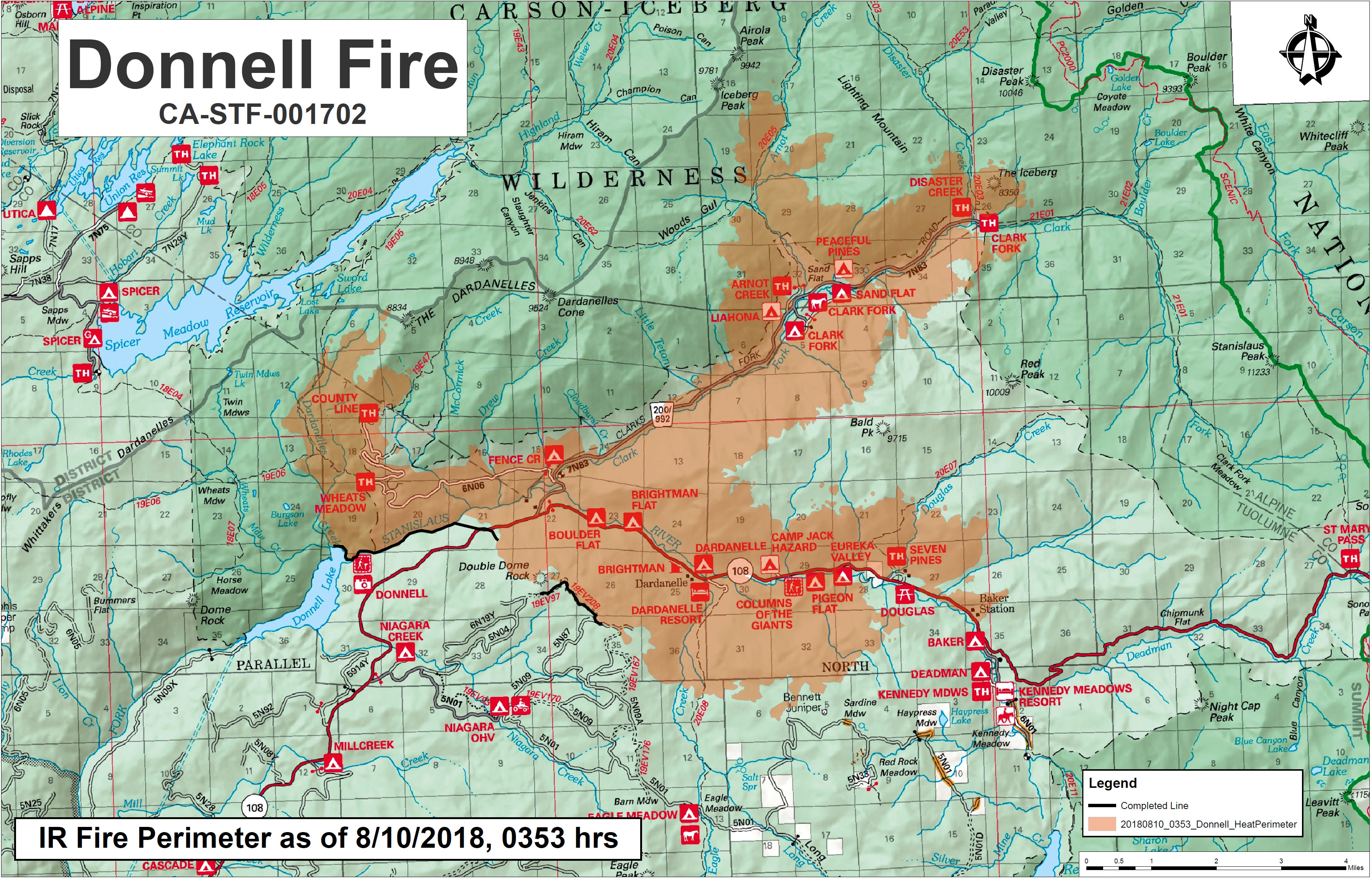
Click Above For Full Sized Map
With the increase in fire equipment and traffic around the Pinecrest area, the public is reminded to drive extra cautiously at this time.
RECREATION RESIDENCE AND FACILITY UPDATE: Mi-Wok/Summit District Ranger Sarah LaPlante completed contacting all permittees affected by the fire yesterday.
A Forest Closure Order for the Carson-Iceberg Wilderness on the Summit and Calaveras Ranger Districts went into effect yesterday. Spicer Reservoir is also within the closure area, campgrounds are open, but the lake is closed to visitor use. Highway 108 is still closed at Eagle Meadow Road from the west and at the top of Sonora Pass on the east side. The Alpine County Sheriff’s Office has closed the gate at the junction of Highway 4 and Highlands Lake Road (Forest Service Road 8N01). The Pacific Crest Trail has also been closed between Highway 108 and Highway 4 for public safety.
Mandatory Evacuations: In effect along Highway 108 from Eagle Meadow Road to Kennedy Meadows (all residences and campgrounds) as well as all along Eagle Meadow Road (5N01) and the Clark Fork Road area. No new mandatory evacuations have been ordered.
Advisory Evacuation: Mill Creek area was put into effect on August 8.
For more information about the Stanislaus National Forest, visit us at www.fs.usda.gov/stanislaus, “like” us on
Facebook at www.facebook.com/StanislausNF, or “follow” us on Twitter at www.twitter.com/StanislausNF.
For more information on the fire please go to https://inciweb.nwcg.gov/incident/6092/
###
LOCATION: Stanislaus National Forest, DATE STARTED: August 1, 2018,
ACRES: 23,824
PERCENT CONTAINED: 5%
STRUCTURES THREATENED: 220
STRUCTURES DESTROYED: 55
MINOR STRUCTURES DESTROYED: 81
TOTAL PERSONNEL: 643
Fire Resources include: 6 Hand Crews, 3 Helicopters, 42 Engines, 5 Dozers, 5 Water Tenders
Donnell Fire Continues to Grow, Growth Heading into Alpine & Upper Calaveras. Now 23,824 Acres added by admin on
View all posts by admin →