


Pinecres, CA…Due to more accurate perimeter mapping a slight decrease in the percentage of containment was noted. Significant decrease in both fire activity and threats to structures allowed firefighters to continue progress on containment. Night crews were pulled off the line at midnight and rotated in this morning with the day crews to assist with patrol efforts. Increased personnel on the fire line and additional heavy equipment will provide more resources for fire containment. The thunderstorm over the eastern portion of the fire yesterday produced little rain and did not increase fuel moisture levels to help firefighting efforts. Firefighters are working hard to keep the established containment lines in place while making progress.
Upcoming weather is predicted to be hotter and drier with winds from the southwest. This may make for more difficult fire-fighting conditions in the coming days.
Overwhelming support from the local community is bolstering firefighter morale allowing them to push through incredibly tough terrain and fatigue.
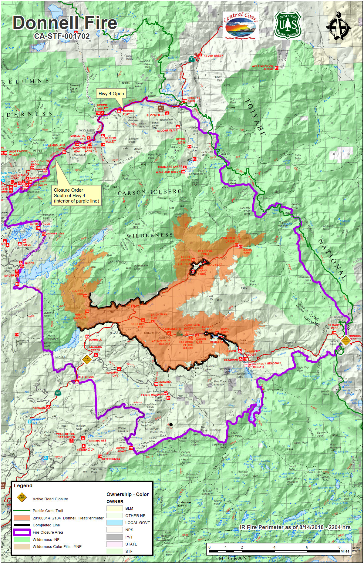
Forest Closures: The area includes the Carson-Iceberg Wilderness on the Summit and Calaveras Ranger Districts as well as Spicer Reservoir. Campgrounds are open, but the lake is closed to visitor use. Highway 108 is still closed at Eagle Meadow Road from the west and at the top of Sonora Pass on the east side. The Alpine County Sheriff’s Office has closed the gate at the junction of Highway 4 and Highlands Lake Road (Forest Service Road 8N01). The Pacific Crest Trail has also been closed between Highway 108 and Highway 4 for public safety.
Mandatory Evacuations: Still in effect along Highway 108 from Eagle Meadow Road to Kennedy Meadows (all residences and campgrounds) as well as all along Eagle Meadow Road (5N01) and the Clark Fork Road area. No new mandatory evacuations have been ordered.
Advisory Evacuation: Mill Creek area was put into effect on August 8th.
For more information about the Stanislaus National Forest, visit us at www.fs.usda.gov/stanislaus, “like” us on
Facebook at www.facebook.com/StanislausNF, or “follow” us on Twitter at www.twitter.com/Stanislaus_NF.
For more information on the fire please go to https://inciweb.nwcg.gov/incident/6092/
Fire Information Line: (209) 536-5388 donnellfirestf1918@gmail.com
LOCATION: Stanislaus National Forest DATE STARTED: August 1, 2018
ACRES: 29,756 PERCENT CONTAINED: 26%
STRUCTURES THREATENED: 220 STRUCTURES DESTROYED: 54
INJURIES/ACCIDENTS: 3 MINOR STRUCTURES DESTROYED: 81
TOTAL PERSONNEL: 934
Fire Resources include: 18 Hand Crews, 5 Helicopters, 48 Engines, 5 Dozers, 8 Water Tenders
The Donnell Fire Now 29,756 Acres, Firefighters Making Progress & Smoke Output Starting to Drop added by admin on
View all posts by admin →