


Pinecrest, CA…It was a relatively quiet night on the fire. The western edge showed little spread. Yesterday crews were able to get a good line in and made significant progress with containment in this area. Today, additional crews and aircraft are working to complete the line near Spicer Reservoir. A small portion of the fire remains active north of Highway 108 and Kennedy Meadows due to steep rugged terrain and patchy vegetation. Crews are working to complete the last short segment of containment line south of Highway 108 between Douglas Picnic Area and the Bennett Juniper. Portable pumps and hose were brought in to support hand crews. Mop up and suppression repair continues along the southern fire boundary. Drier weather, lower humidity and increased west to southwesterly winds may intensify fire activity this afternoon. With very low fuel moisture and limited recovery overnight, vegetation continues to burn for extended periods. Today is the fifth anniversary of the Rim Fire, the largest wildfire to occur in the Sierra Nevada. Half a decade later, local staff continues to work on restoration efforts.
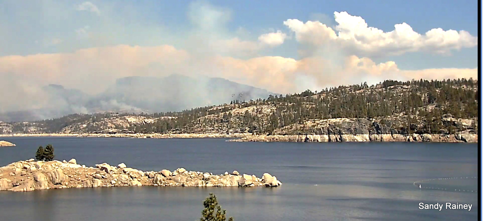
On August 15th from the Spicer Spillway
Current Closures:
August 4: California Highway Patrol closed Highway 108 at Eagle Meadow Road from the west and at the top of Sonora Pass on the east side.
August 6: U.S. Forest Service closed the Pacific Crest Trail between Highway 108 and Highway 4 for public safety.
August 9: Alpine County Sheriff’s Office closed the gate at the junction of Highway 4 and Highland Lakes Road (Forest Service Road 8N01).
August 9: U.S. Forest Service signed the Fire Closure Order restricting public access within and adjacent to the fire.
Mandatory Evacuations: Still in effect along Highway 108 from Eagle Meadow Road to Kennedy Meadows (all residences and campgrounds) as well as all along Eagle Meadow Road (5N01) and the Clark Fork Road area. No new mandatory evacuations have been ordered.
Advisory Evacuation: Mill Creek area was put into effect on August 8th.
For more information about the Stanislaus National Forest, visit us at www.fs.usda.gov/stanislaus, “like” us on
Facebook at www.facebook.com/StanislausNF, or “follow” us on Twitter at www.twitter.com/Stanislaus_NF.
For more information on the fire please go to https://inciweb.nwcg.gov/incident/6092/
Friday August 17, 2018 @ 8am
Fire Information Line: (209) 536-5388 donnellfirestf1918@gmail.com LOCATION: Stanislaus National Forest DATE STARTED: August 1, 2018 ACRES: 31,369 PERCENT CONTAINED: 36% STRUCTURES THREATENED: 220 STRUCTURES DESTROYED: 54 INJURIES/ACCIDENTS: 3 MINOR STRUCTURES DESTROYED: 81 TOTAL PERSONNEL: 865 Fire Resources include: 18 Hand Crews, 5 Helicopters, 39 Engines, 2 Dozers, 8 Water Tenders
The Donnell Fire Grows to 31,369 Acres, Containment Climbs to 36% added by admin on
View all posts by admin →