


Arnold, CA…The Detailed forecast from the National Weather Service for West Slope Northern Sierra Nevada. Today
Mostly sunny. Warmer. Highs 47 to 62 higher elevations… 59 to 69 lower elevations. Prevailing east winds up to 10 mph shifting to the southwest in the afternoon. Tonight Partly cloudy. Lows 27 to 42 higher elevations…40 to 48 lower elevations. Prevailing southwest winds up to 10 mph shifting to the southeast after midnight.
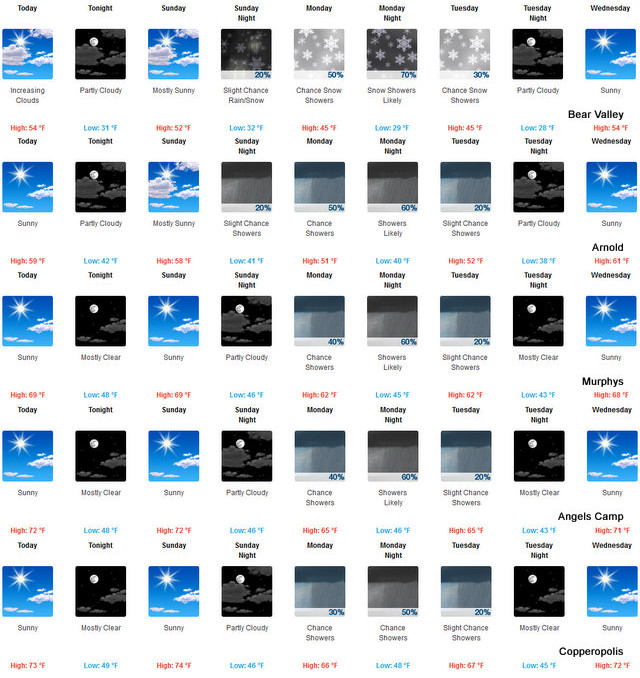
Sunday
Mostly sunny in the morning then becoming partly cloudy. Highs 45 to 60 higher elevations…57 to 69 lower elevations. Prevailing south winds up to 15 mph with gusts to around 35 mph…except southwest 10 to 30 mph over ridges.
Sunday Night
Mostly cloudy. A chance of rain and snow showers in the evening, then a slight chance of rain and snow showers after midnight. Lows 27 to 41 higher elevations…37 to 47 lower elevations. Snow level 7500 feet. Prevailing south winds 10 to 20 mph with gusts to around 35 mph…except southwest 20 to 35 mph over ridges.
Monday
Mostly cloudy. A chance of rain and snow showers. Highs 39 to 54 higher elevations…48 to 62 lower elevations. No snow accumulation lower elevations…up to 3 inches higher elevations. Snow level 6500 feet. Prevailing south winds 5 to 15 mph with gusts to around 40 mph…except southwest 20 to 35 mph over ridges.
Monday Night
Cloudy with rain and snow showers likely. Moderate snow accumulations possible. Lows 28 to 43.
Tuesday
Mostly cloudy with a chance of rain and snow showers. Highs 43 to 58.
Tuesday Night And Wednesday
Mostly clear. Lows 27 to 42. Highs 48 to 63.
Wednesday Night And Thursday
Clear. Lows 32 to 47. Highs 55 to 70.
Thursday Night And Friday
Mostly clear. Lows 35 to 50. Highs 57 to 72.
A Bit of Winter Returns Mid-Week To Spice Up Your Spring Along the Western Slope & Mother Lode added by admin on
View all posts by admin →