Over 2,000 PG&E Customers in Greater Murphys Area Powerless Tonight
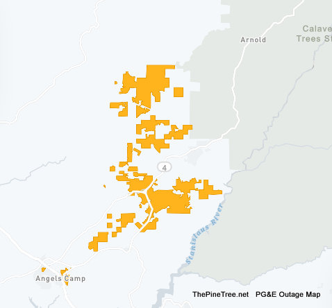
Murphys, CA…Over 2,000 PG&E Customers in Greater Murphys Area Powerless Tonight. Crews are assessing the cause and a restoral time has not been estimated yet.

Murphys, CA…Over 2,000 PG&E Customers in Greater Murphys Area Powerless Tonight. Crews are assessing the cause and a restoral time has not been estimated yet.
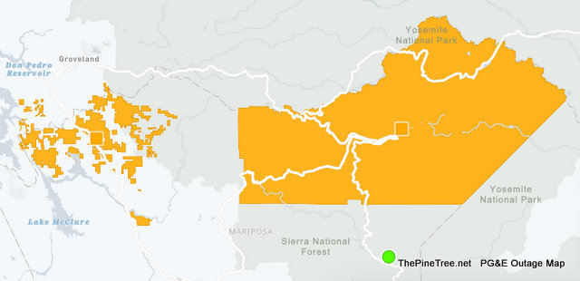
Yosemite, CA…Yosemite National Park & Much of the Hwy 49 Corridor from Coulterville south is without power at this time. PG&E is reporting restoral times between 11pm and 1am for the various areas.
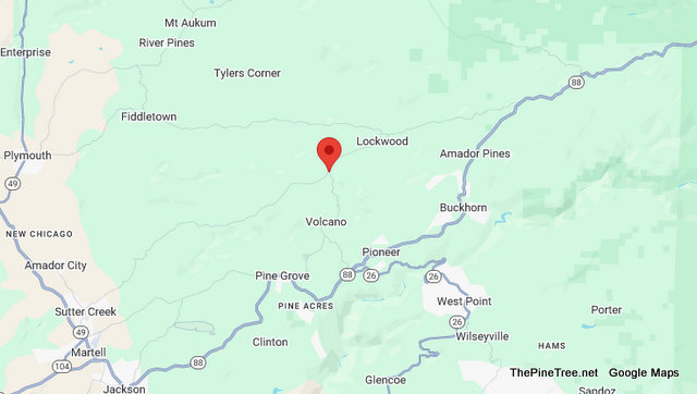
Lockwood, CA…Traffic Update…Solo Vehicle Collision Near Rams Horn Grade / Shake Ridge Rd Incident: 0275 Type: Trfc Collision-1141 Enrt Location: Rams Horn Grade / Shake Ridge Rd Loc Desc: SB JSO Lat/Lon: 38.473324 -120.625996 Detail Information 7:53 PM 3 [7] CALFIRE / SOLO VEH T/C / POS 1182 7:41 PM 2 [6] 1039 AMASO – […]
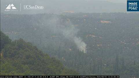
Tuolumne, CA…Traffic & Fire Update….Inks Fire Held to .25 Acre Near Tuolumne Rd N / Cherokee Rd. Another great job by our firefighters!!!! Incident: 0176 Type: Report of Fire Location: Tuolumne Rd N / Cherokee Rd Loc Desc: JEO Lat/Lon: 37.976935 -120.246705 Detail Information 1:25 PM 2 [2] B61-002B OW FIRE 1:25 PM 1 [1] […]
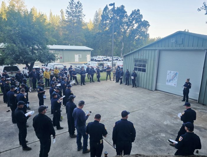
Pioneer, CA…(Update – Saturday, 7:10 am): Forward progress has been stopped. Firefighters worked through the night and successfully held the Tiger Fire at 117 acres, and containment is now at 10%. Their hard work continues this morning as day shift crews gear up to hit the line – focused on keeping the fire within its […]
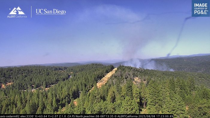
Pioneer, CA…Firefighters on ground and in the air have done a phenomenal job this afternoon getting the upper hand on the Tiger Fire. While far from out smoke output has dropped significantly and the fire’s ability to explode to a larger much larger fire has probably been taken out of it. The latest from CAL […]
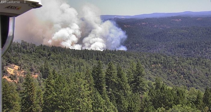
Buckhorn, CA…As we head into the heart of fire season the Tiger Fire has all the ingredients of a potentially bad one. It is burning at an elevation where there is lots of heavy fuel and it is late enough into the season that the fuel moisture load is low. Officially estimated at 34 acres […]
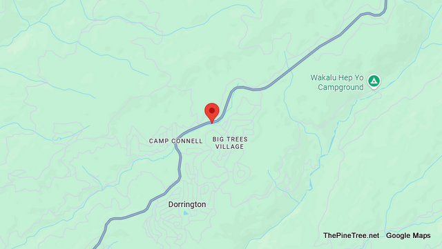
Dorrington, CA…Traffic & Bovine Update….Three Cows on Side of Road Near Hwy 4 & Ottawa Dr Incident: 0093 Type: Live or Dead Animal Location: Sr4 / Ottawa Dr Loc Desc: EB 4 Lat/Lon: 38.314407 -120.267062 Detail Information 9:50 AM 1 [1] 3 COWS ON SIDE OF RD Unit Information 9:57 AM 1 Unit Assigned
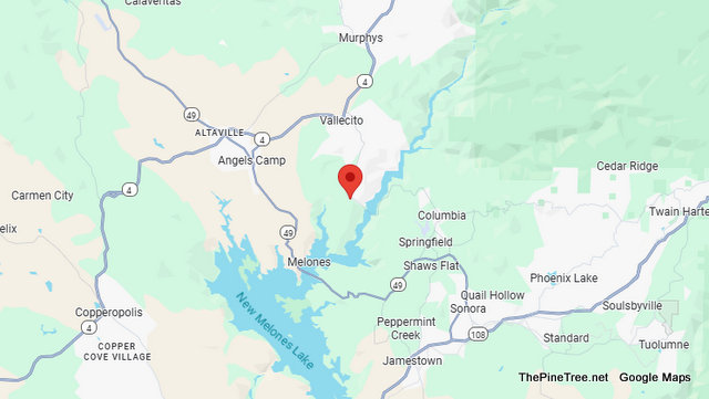
Vallecito, CA…Traffic Update….Solo Injury Vehicle Off Roadway Collision off Parrotts Ferry Road Incident: 0153 Type: Trfc Collision-1141 Enrt Location: 4497 Parrots Ferry Rd Loc Desc: Lat/Lon: 38.046756 -120.467548 Detail Information 2:04 PM 3 [13] B49-030 SOLO VEH 1181 1:45 PM 2 [3] FIRE STARTING 1:45 PM 1 [2] PK TK WENT OFF RDWY – 2 […]
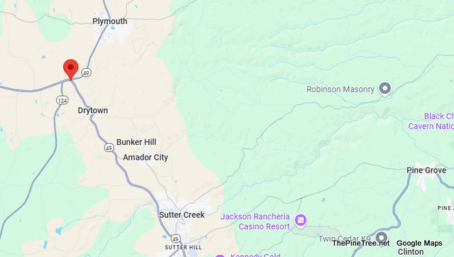
Drytown, CA…Traffic Update….Fatal SUV vs Mustang Head on Collision Near Hwy 49 & Hwy 16 Incident: 0132 Type: Fatality Location: Sr49 / Sr16 Loc Desc: SB 49 JSO SR16 Lat/Lon: 38.454840 -120.867746 Detail Information 1:16 PM 10 [50] A94-001 1185 FOR FORD MUS / MAJ DMG [Shared] 1:10 PM 9 [46] 1039 CT [Shared] 12:59 […]
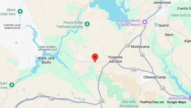
Jamestown, CA…Traffic Update…Minor Injury Pickup vs Pole Collision Near Obyrnes Ferry Rd / George Reed Rock Plant Rd Incident: 0147 Type: Trfc Collision-1141 Enrt Location: Obyrnes Ferry Rd / George Reed Rock Plant Rd Loc Desc: IFO GEORGE REED Lat/Lon: 37.887646 -120.516379 Detail Information 12:57 PM 15 [22] PGE ETA @ 13:24 [Shared] 12:53 PM […]
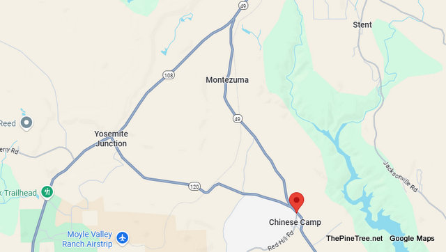
Chinese Camp, CA…Traffic Update….Possible Injury Vehicle vs Sign Collision Near Sr120 / Red Hills Rd Incident: 0125 Type: Trfc Collision-1141 Enrt Location: Sr120 / Red Hills Rd Loc Desc: ACROSS FROM CHINESE CAMP STORE Lat/Lon: 37.873389 -120.432859 Detail Information 11:38 AM 6 [11] [Rotation Request Comment] 1039 VICS 209-532-4523 +++++++++++++++++++ 11:37 AM 5 [10] 61-S1 […]
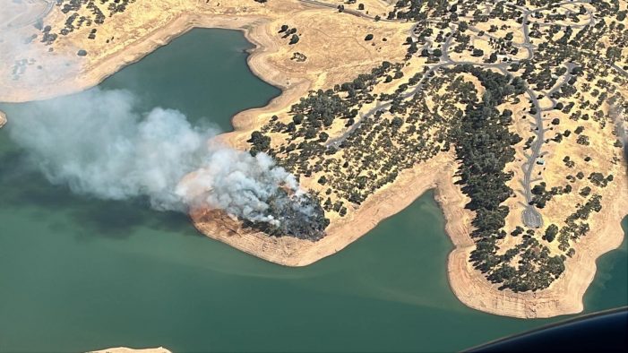
Angels Camp, CA…Great Work by Firefighters in holding the Iron fire to 1.5 Acres. Firefighters are responded to the report of a vegetation fire near the Ironhorse Campground, Whittle Road- New Melones Lake- Angels Camp. (Update 8.5.25 3:11pm) Firefighters have stopped the forward progress of the fire. (Update 8.5.25 2:44pm) The fire is 1.5 acres […]
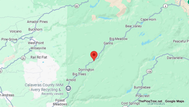
Dorrington, CA…Traffic Update….Deer May Have Won in Vehicle vs Deer Collision Near Forest Rte-6N80. Vehicle may be undrivable & the deer continued on. Incident: 0113 Type: Trfc Collision-No Inj Location: Sr4 / Forest Rte-6n80 Loc Desc: EB 4 JWO Lat/Lon: 38.330954 -120.237032 Detail Information 12:27 PM 5 [7] PULLED TO RHS 12:26 PM 4 [6] […]
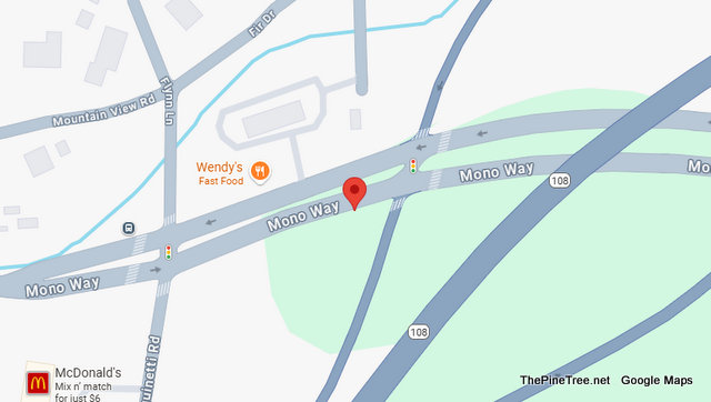
Sonora, CA…Traffic Update….Vehicle vs Wendy’s Sign Near Hwy 108 Business & Fir Drive Incident: 0282 Type: Hit and Run No Injuries Location: Sr108 Bus / Fir Dr Loc Desc: 13050 MONO – WENDYS Lat/Lon: 37.976037 -120.359343 Detail Information 5:25 PM 2 [2] BLU VEH 5:25 PM 1 [1] VEH TOOK OUT ONE OF THE ENTRANCE […]
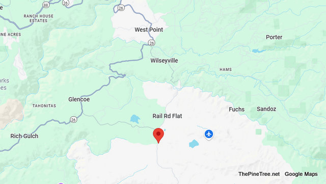
Rail Road Flat, CA…Traffic Update…Solo Motorcycle Collision on Railroad Flat Road Incident: 0244 Type: Trfc Collision-Unkn Inj Location: 505 Railroad Flat Rd Loc Desc: JWO Lat/Lon: 38.326044 -120.519475 Detail Information 5:24 PM 1 [1] SOLO MC TC RR FLAT JWO 505 S RR FLAT Unit Information 5:24 PM 3 Unit At Scene 5:24 PM 2 […]
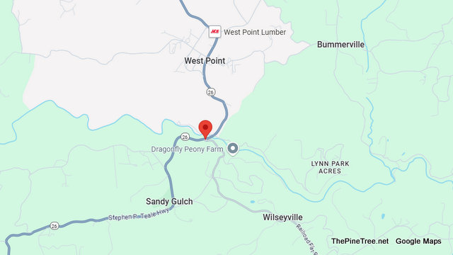
Wilseyville, CA…Traffic Update….Collision Near Sr26 / N Railroad Flat Rd Incident: 0166 Type: Trfc Collision-No Inj Location: Sr26 / N Railroad Flat Rd Loc Desc: Lat/Lon: 38.389065 -120.527285 Detail Information 1:35 PM 2 [3] VEH NOT DRVABLE 1:35 PM 1 [2] OCCPS OO VEH Unit Information 2:22 PM 3 Unit At Scene 2:22 PM 2 […]
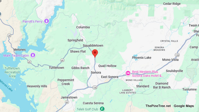
Sonora, CA…Traffic Update….Possible Injury Multiple Vehicle Collision Near Sr49 / Columbia Way Incident: 0109 Type: Trfc Collision-1141 Enrt Location: Sr49 / Columbia Way Loc Desc: SB IFO ARCO Lat/Lon: 38.000679 -120.383574 Detail Information 10:05 AM 5 [11] 1039 CDF [Shared] 10:05 AM 4 [9] 1039 EMS [Shared] 10:05 AM 3 [8] ADDTL CALLER ADVG 4 […]
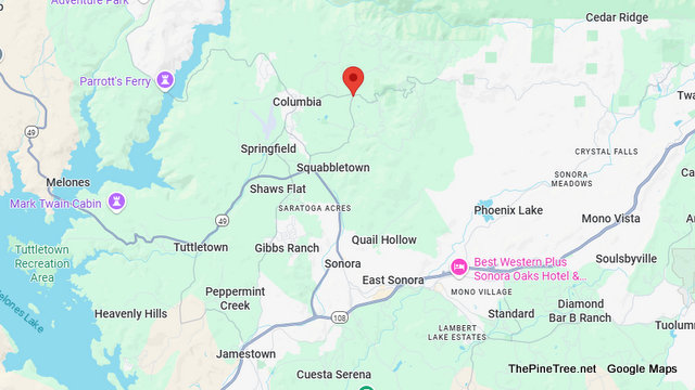
Columbia, CA…Traffic Update….Collision Near Sawmill Flat Rd / Big Hill Rd Incident: 0300 Type: Trfc Collision-Unkn Inj Location: Sawmill Flat Rd / Big Hill Rd Loc Desc: Lat/Lon: 38.038342 -120.377768 Detail Information NO DETAILS Unit Information 6:08 PM 3 Unit Enroute 6:08 PM 2 Unit Assigned
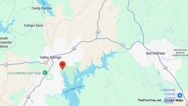
Valley Springs, CA…Traffic Update….Minor Injury Vehicle vs Tree Collision Near Hogan Dam Rd / New Hogan Pkwy Incident: 0078 Type: Trfc Collision-Minor Inj Location: Hogan Dam Rd / New Hogan Pkwy Loc Desc: Lat/Lon: 38.177590 -120.812361 Detail Information 9:53 AM 6 [18] A49-001 180: BLK SCION TC 2 PLTS 22651B 9:52 AM 5 [17] [Notification] […]
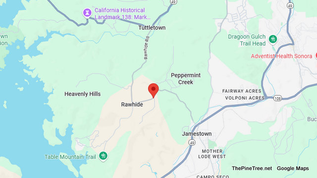
Sonora, CA…Traffic Update….Pickup vs Boulder Near Rawhide Rd / Omega Mine Rd Incident: 0176 Type: Trfc Collision-No Inj Location: Rawhide Rd / Omega Mine Rd Loc Desc: JEO Lat/Lon: 37.965192 -120.441029 Detail Information 4:45 PM 11 [30] A61-003 RDWY CLR//ENRT VICS FOR 180 3:59 PM 10 [23] A61-003 RDWY SHUT DOWN FOR RECOVERY [Shared] 3:49 […]
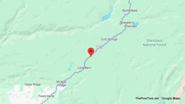
Long Barn, CA…Traffic Update…Overturned Vehicle vs Fire Hydrant Collision on Hwy 108 Incident: 0337 Type: Trfc Collision-No Inj Location: 25026 Sr108 Loc Desc: Lat/Lon: 38.126493 -120.105114 Detail Information 10:02 PM 12 [19] [Rotation Request Comment] 1039 AFFORDABLE TOW 2099842414 [Shared] 10:02 PM 11 [18] 1039 CALFIRE [Shared] 10:02 PM 10 [17] 1039 TUOL UTILITY [Shared] […]
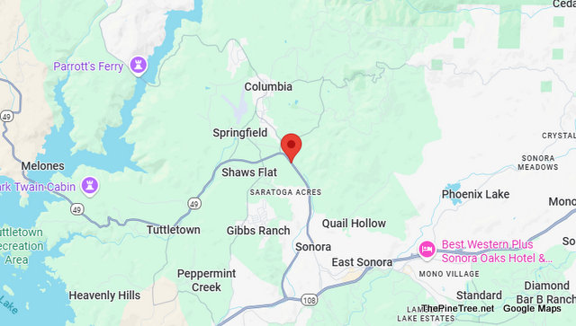
Sonora, CA…Traffic Update…Hit n Run with Injuries Near Sr49 / Old Sonora Columbia Rd Incident: 0109 Type: Hit and Run w/Injuries Location: Sr49 / Old Sonora Columbia Rd Loc Desc: Lat/Lon: 38.010970 -120.391665 Detail Information 12:22 PM 12 [36] 1039 1 11:47 AM 11 [32] 1039 SPD / TUOL SO / CSO / SAN ANDREAS […]
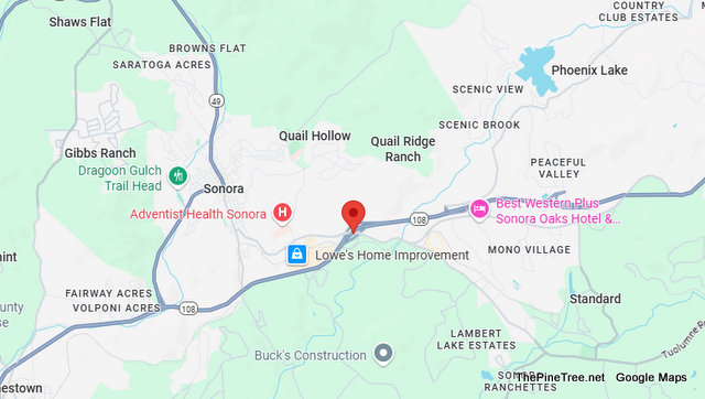
Sonora, CA…Traffic Update….Collision Near Hwy 108 & Lower Mono Incident: 0102 Type: Trfc Collision-Minor Inj Location: Sr108 / Lower Mono Loc Desc: WB JWO Lat/Lon: 37.976439 -120.357655 Detail Information 11:57 AM 12 [50] [Notification] [CHP]-Problem changed from 1182-Trfc Collision-No Inj to 1181-Trfc Collision-Minor Inj by CHP [Shared] 11:57 AM 11 [49] 3 VEH 1181 11:43 […]
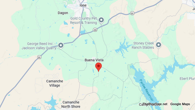
Buena Vista, CA…Traffic Update…Hit n Run with Injuries on Coal Mine Rd Incident: 0083 Type: Hit and Run w/Injuries Location: 4640 Coal Mine Rd Loc Desc: OCCRD 88/BUENA VISTA Lat/Lon: 38.281858 -120.911578 Detail Information 8:22 AM 2 [5] HANDLE BARS HIT / MIRROR BROKEN / FINGERS BLEEDING 8:22 AM 1 [4] SV – UNKN WHI […]

Sonora, CA…Firefighting crews from the Stanislaus National Forest are currently responding to two confirmed wildfires as well as two smoke checks/possible fires. In the last 24 hours, there have been 289 lightning strikes with 72 confirmed ground contacts. Currently Responding Kitchen Fire – west of Union Reservoir, fire is sized up at 30 ft x […]
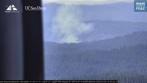
Avery, CA…South of Avery but in Tuolumne County….(Update 7.30.25 1:06pm) The fire is holding within retardant lines at 4 to 5 acres. There is minimal fire activity. (Update 7.30.25 11:08am) The fire is 4 acres with difficult access. additional resources are responding. #Mccormickfire Firefighters are at scene of a 3 acre vegetation fire near forest […]
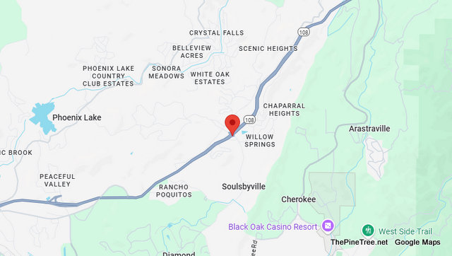
Soulsbyville, CA…Traffic & Fire Update….Lots of Smoke & Possible Big Rig Fire Near Soulsbyville Rd / Sr108 Incident: 0179 Type: Car Fire Location: Soulsbyville Rd / Sr108 Loc Desc: Lat/Lon: 37.996501 -120.267201 Detail Information 3:28 PM 3 [3] 1039 FIRE 3:28 PM 2 [2] ALOT OF SMOKE NO FLAMES SEEN 3:28 PM 1 [1] SEMI […]
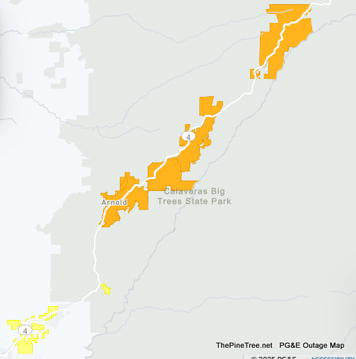
Arnold, CA…The overnight thunderstorms have knocked out power to a good portion of the Arnold area. PG&E is saying that the estimated restoral time is 2pm today!

Sonora, CA…Senator Marie Alvarado-Gil (R-Jackson) is calling for the reclassification of J-59/La Grange Road as State Route 59 to improve public safety and strengthen California’s wildfire emergency response system. This vital corridor connects State Route 99 to State Route 108 and serves thousands of residents, first responders, and travelers each year. Despite its importance, it […]