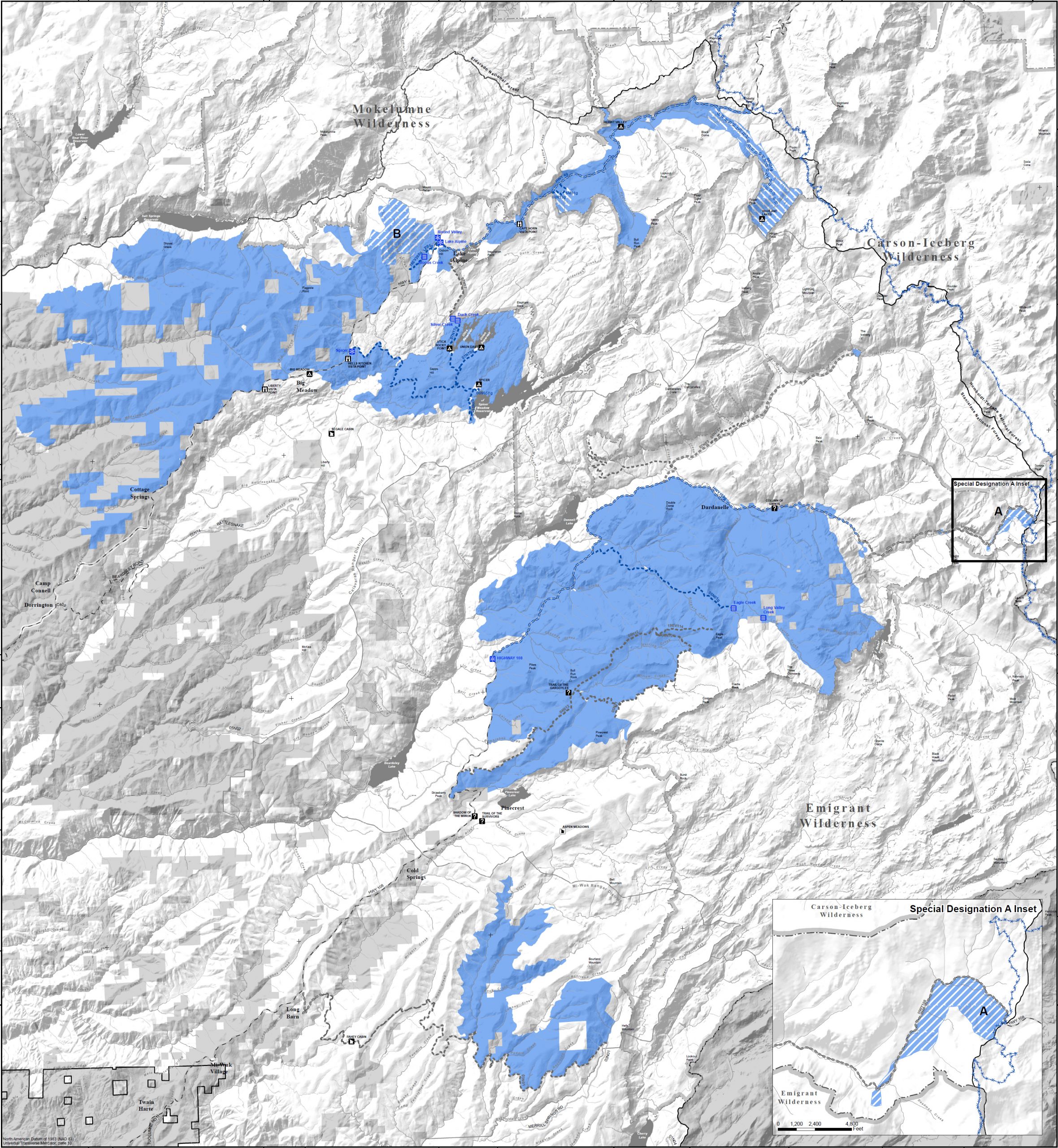
Sonora, CA…The Forest Service has designated a system of trails and areas for OSV use on the Stanislaus National Forest to provide public access and ensure the safety and enjoyment for all users. The Over-Snow Vehicle Use Map (OSVUM) identifies where and when OSV-use is authorized to occur.
Click Above for full sized version of map.
The Stanislaus National Forest OSV-use designations include:
• 119,104 acres of cross-country OSV use
• 24.7 miles of NFS OSV-use trails available for grooming
• 58.4 miles of un-groomed NSF OSV-use trails
• Minimum snow depth requirements
The Stanislaus National Forest’s OSV-use designations were selected after a multiple-year planning and public review process to provide winter recreation and balance resource protection. The resulting OSV-use designations complete Subpart C of the Travel Management Rule. Forest Supervisor Jason Kuiken said, “It is a balancing act to meet the needs of multiple uses and ensure forest resources are protected. We listened carefully to our stakeholders to come up with a balanced approach that provides the public with motorized and non-motorized winter recreational opportunities while natural resources, including sensitive species, are preserved and maintained for future generations to enjoy.”
The OSV-use designations displayed on the OSVUM are in effect immediately. It is the sole responsibility of users to obtain the OSVUM and only operate OSVs where and under what conditions OSV-use is authorized according to the information presented on the OSVUM.
Visitors and OSV-users can obtain an OSVUM at Stanislaus National Forest offices or online at: https://www.fs.usda.gov/…/FSE_DOCUMENTS/fseprd988315.pdf
For a video introduction to the OSVUM offered by Forest Supervisor Jason Kuiken, please see the following link:
https://www.facebook.com/StanislausNF/videos
To review the planning documents, visit the OSV-use Designation project website at: https://www.fs.usda.gov/project/?project=46311
###
USDA is an equal opportunity provider, employer, and lender>


