


Arnold, CA…This highway information is the latest reported by Caltrans as of Wednesday, January 3rd, 2024 at 11:36 AM. With the search tool at the bottom of our weather page you can search as many roads as you need. Same back end data but quicker than Quickmap.
SR 4
[IN THE CENTRAL CALIFORNIA AREA]
Is closed from 0.5 mi east of the Jct of SR 207 /Mt Reba Turnoff/ to 2.2 mi west of the Jct of SR 89 /Ebbetts Pass/ (Alpine Co) – For the winter – Motorists are advised to use an alternate route
Chains are required on all vehicles except 4-wheel-drive vehicles with snow tires on all 4 wheels from Camp Connell (Calaveras Co) to the Mt Reba Turnoff (Alpine Co)
Please research chain control locations as Caltrans is currently working to update chain control descriptions for consistency with internet mapping, like Google Maps & Mapquest
SR 26
[IN THE CENTRAL CALIFORNIA & SIERRA NEVADA]
No traffic restrictions are reported for this area.
SR 49
[IN THE CENTRAL CALIFORNIA AREA]
No traffic restrictions are reported for this area.
[IN THE NORTHERN CALIFORNIA AREA]
Chains or snow tires are required from Sierra City to Sattley (Sierra Co)
Please research chain control locations as Caltrans is currently working to update chain control descriptions for consistency with internet mapping, like Google Maps & Mapquest
SR 88
[IN THE CENTRAL CALIFORNIA AREA & SIERRA NEVADA]
Chains are required on all vehicles except 4-wheel-drive vehicles with snow tires on all 4 wheels from Dew Drop (Amador Co) to 1 mi west of Woodfords (Alpine Co)
Chains are required on all vehicles except 4-wheel-drive vehicles with snow tires on all 4 wheels from 4 mi east of Ham’s Station (Amador Co) to 5 mi west of Pickett’s Jct (Alpine Co)
Please research chain control locations as Caltrans is currently working to update chain control descriptions for consistency with internet mapping, like Google Maps & Mapquest
SR 108
[IN THE CENTRAL CALIFORNIA AREA & SIERRA NEVADA]
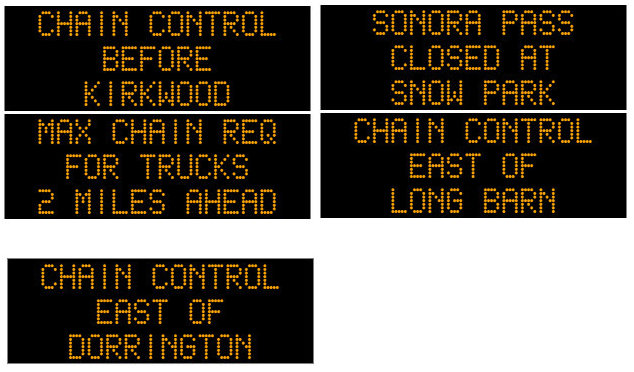
Is closed from 7.2 mi east of Strawberry (Tuolumne Co) to 7.7 mi west of the Jct US 395 (Mono Co) /Sonora Pass/ – For the winter – Motorists are advised to use an alternate route
Chains are required on all vehicles except 4-wheel-drive vehicles with snow tires on all 4 wheels from Long Barn to 7.2 mi east of Strawberry (Tuolumne Co)
Chains or snow tires are required from 3.8 mi west of the Jct of US 395 to the Jct of 395 (Mono Co)
Please research chain control locations as Caltrans is currently working to update chain control descriptions for consistency with internet mapping, like Google Maps & Mapquest
[YOSEMITE NAT’L PARK]
For Yosemite Nat’l Park road information call 209-372-0200
SR 120
[IN THE CENTRAL CALIFORNIA AREA & SIERRA NEVADA]
Is closed from Crane Flat to 4.5 mi west of the Jct of US 395 /Tioga Pass/ (Mono Co) – For the winter – Motorists are advised to use an alternate route
Chains are required on all vehicles except 4-wheel-drive vehicles with snow tires on all 4 wheels from 14.5 mi east of Groveland to the Yosemit National Park Boundry (Tuolumne Co)
Chains or snow tires are required from Benton Crossing Rd to Yellow Jackt Rd /(Mono Co)
Please research chain control locations as caltrans is currently working to update chain control descriptions for consistency with internet mapping, like google maps & mapquest.
[YOSEMITE NAT’L PARK]
For Yosenite Nat’l Park road information call 209-372-0200
Chain Controls on Hwys 88, 4, 108 & 120 added by admin on
View all posts by admin →