

Angels Camp, CA…Fall in Calaveras County brings a dazzling show of golden leaves, crisp mountain air, and endless blue skies that are perfect for hiking, biking, or a peaceful scenic drive. Just a short trip from Sacramento or the San Francisco Bay Area, it’s the ideal autumn getaway between Yosemite and Lake Tahoe.
Ebbetts Pass Scenic Byway
Scenic Drive: Highway 4 from Copperopolis to Bear Valley: Drive Highway 4 up to Bear Valley and enjoy beautiful fall colors all the way up. Weather permitting, drive to Dorrington (just past Arnold), turn right at Boards Crossing and drive about 5 miles to Sourgrass Day Use.
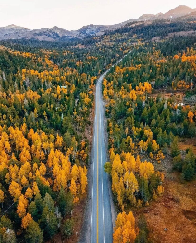
Situated along Highway 4, running east through the High Sierra, the Ebbetts Pass corridor’s fall colors typically begin showing before moving towards the historic Gold Country towns. Travel along Highway 4 through the Ebbetts Pass National Scenic Byway, a breathtaking 61-mile stretch winding east through the High Sierra. As autumn arrives, vibrant fall foliage begins to light up this route before spreading down into the historic Gold Country towns. Recognized as one of only seven National Scenic Byways in California, this hidden gem offers spectacular views of glacial valleys, Giant Sequoia groves, river canyons, granite cliffs, and even natural hot springs. The drive between Arnold and Markleeville transitions from wide, modern roads to narrow, winding mountain passes that cross the Sierra crest, offering a true off-the-beaten-path adventure. If weather and road conditions permit, this is a must-do fall drive in the Sierra Nevada, far from the crowds of the big cities.
Want a preview? Check out the fall foliage video at www.scenic4.org around the four-minute mark!
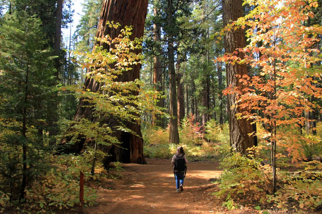
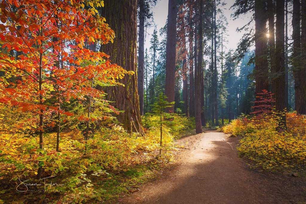
Looking for dogwoods? The gorgeous dogwoods start showing their fall colors going from yellow to orange, to red, and then to a near translucent pink just before the leaves fall, and can be found anywhere from Avery to Calaveras Big Trees State Park. The best trails to find dogwoods are at Big Trees State Park, on the Arnold Rim Trail and at White Pines Lake. Choose the 1.5 or 3.5 mile North Grove loop trails at Calaveras Big Trees, perfect short trails for winter exercise. Bring your hiking boots, mountain bikes, or your horses to the Arnold Rim Trail which has trails for hiking, biking, and horseback riding! White Pines Lake has a playground, pickleball court, serene fishing, disc golf, and bbq areas making it the perfect fall family outing.
Mokelumne River

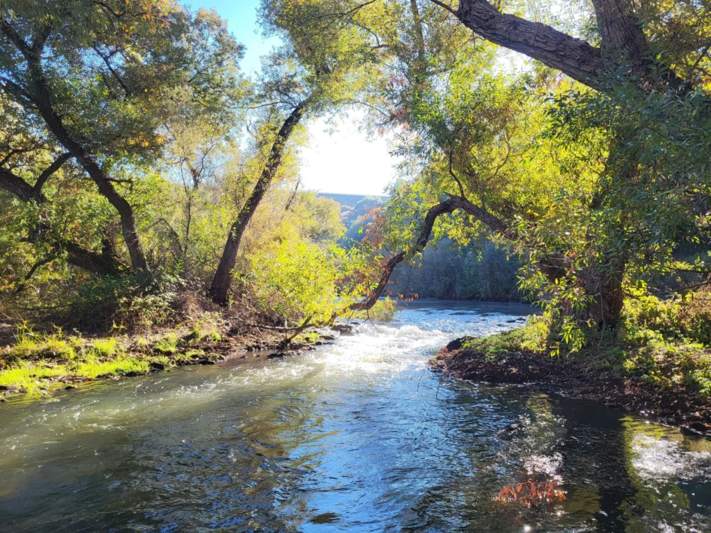
Scenic Drive: Highway 49 from Angels Camp to Mokelumne Hill: Drive down the Golden Chain Highway (Highway 49) and you will see three of Calaveras’ four historic towns – Angels Camp, San Andreas, and Mokelumne Hill. Drive a little past Mokelumne Hill to the Middle Bar Bridge area and access the Mokelumne River. A nice place to get out, walk around a bit, and maybe have a picnic among the golden-hued trees.
Scenic Drive: Highway 49/26: Head to Mokelumne Hill and drive east Highway 26. Continue past the mountain town of West Point and eventually will come to Highway 88 in Amador County. Take 88 back down through Jackson back to Highway 49 to loop back to Mokelumne Hill and into Calaveras County.
From Highway 49, make sure to turn in to see historic downtown Mokelumne Hill. Sometimes, it’s easy to miss, so remember it’s just a little past (or before) the 4-way stop.Usually open Thursday – Sunday, this is a great place to stop to have a great meal at the Hotel Leger or Renegade Winery, a picnic in Shutter Tree park under colorful foliage, and shop in unique gift shops and art galleries. Posterity Ciderworks, a family-owned-and-operated hard cider crafter, is well worth the visit and tasting if you are a hard-cider connoisseur. Featured in two Michelin-star restaurants in Sacramento, don’t miss this gem tucked in our hills.
Head southwest about 3 miles to the Mokelumne River. Turn right on Big Bar Road, then left on Big Bar Launch. You can walk out on Electra Road for about three miles to take in the gorgeous orange, yellow, and red leaves and the temperatures are still pretty mild this times of year.
New Hogan Reservoir
Scenice Drive: Highway 12/26: Whether you’re coming from the SF Bay Area, Sacramento, or the San Joaquin Valley area, this gently winding drive to New Hogan Reservoir will be filled with autumn colors, beautiful farmlands, and maybe a pumpkin patch along the way!
New Hogan Reservoir hikes are great if you are looking for fall colors, but a little bit warmer temperatures. Below the dam at the Monte Vista Recreation area, you will find the River of Skulls Trail, an easy, .9 mile loop hiking trail. There is also a staging area for an eight mile equestrian trail to enjoy a scenic loop that winds along the foothills and lake. The west side of the lake includes bicycle trails that can be enjoyed by beginners and advanced riders. Easy to moderate loop trails ranging 5 to 10 miles include Cameron, Coyote, and Hogan and are dog-friendly (just keep them on a leash).
Scenic Drive: Another nice little drive from Valley Springs to Lake Pardee through Campo Seco. From Highway 26, turn on Laurel Street, then right on Daphne. Continue onto Paloma Road, keeping left onto Watertown Road. Turn right on Campo Seco Road, then left on Sandretto Road following it all the way Pardee Dam Road to the vista point. From here, you will get to soak in a view of the blue lake and all of the fall colors.
See historical markers along the way telling the story of communities of indigenous people and gold fortune-seekers all while winding through peaceful country backroads.

Want to stay a few days? We’d love to have you! Click here for where to stay, where to eat, and things to do throughout Calaveras! Or, give us a call at 209-736-0049 at the Calaveras Visitors Bureau for help planning your next visit to Calaveras. We look forward to seeing you!
Happy travels!
Where to Find Fall Colors in Calaveras ~ CVB Feature added by admin on
View all posts by admin →