


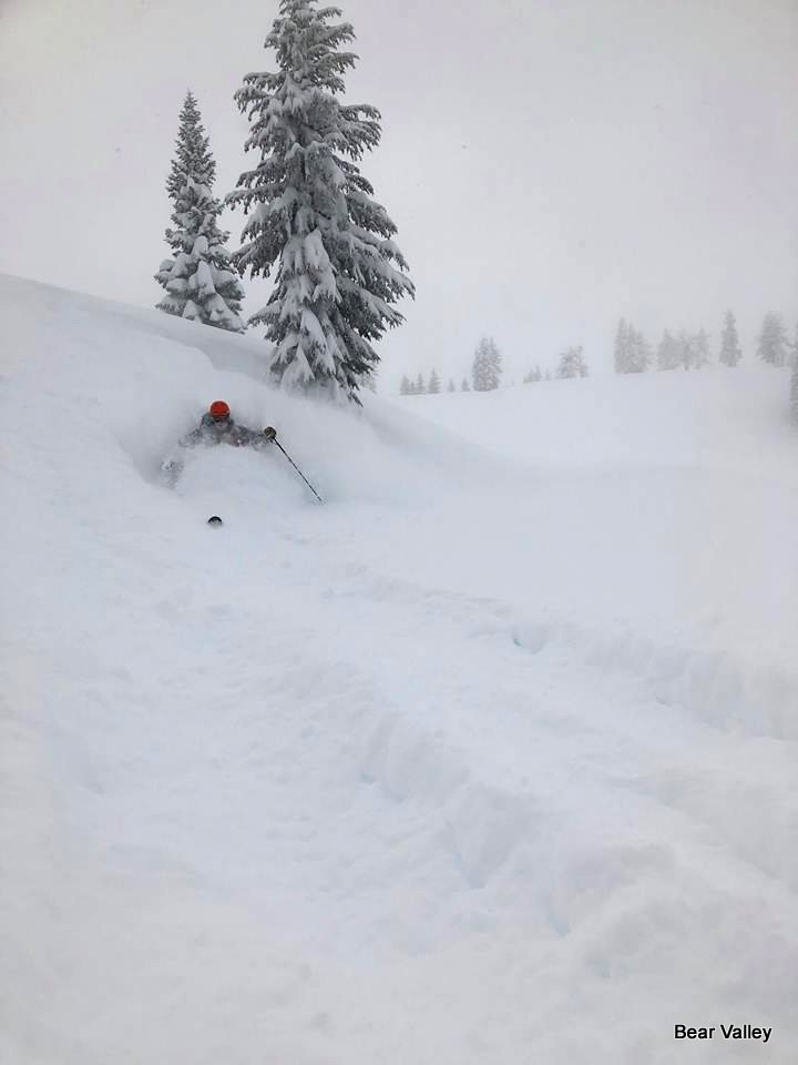
Bear Valley, CA…Hey Good People! 5″ of new snow overnight! Cold temps this morning with 13F at 5am as the broad trough continues to push cold air out of British Columbia to the lower West Coast. With a high of 22F today and an expected 4-8″ of cold smoke type snow it’s gonna be a great day for skiing and riding. Snow showers are expected tonight as the current storm system heads East. Monday is set up for an amazing day with mostly sunny skies and a high of 25F. The recent storm of 49″ brought with it some complex weather with copious amounts of rain up and down for 36hrs then temps dropped and finishing with cold snow making all of the skiers and riders stoked with incredible pow riding. Patrol will be ciphering out the Avalanche Conditions this morning on the upper Mtn while the Grizz Bowl will remain offline for the next few days due to copious amounts of water saturation and avalanche hazards present and the need to let the snow pack consolidate and bond. Don’t forget to come check out our Pure Mtn Fun as we have lots of it going on this President Holiday weekend.


Sunday
Snow showers, mainly before 4pm. High near 22. Southwest wind 5 to 8 mph. Chance of precipitation is 90%. New snow accumulation of 4 to 8 inches possible.
Sunday Night
A 40 percent chance of snow showers before 10pm. Partly cloudy, with a low around 13. Wind chill values as low as -2. East northeast wind 14 to 17 mph, with gusts as high as 26 mph. New snow accumulation of less than a half inch possible.
Peace Out,
Mattly
February 17 2019 13F @5am S winds 5-9mph base 159” current storm total 49” season total 367”
Hey Good People!! Powder to the People on a 159 Inch Base at Bear Valley added by admin on
View all posts by admin →